KARPATHOS

Popular destinations GREECE
| Aegina | Alonissos | Andros |
| Chios | Corfu | Crete |
| Hydra | Kalymnos | Karpathos |
| Kefalonia | Kos | Lefkas |
| Lesbos | Mykonos | Naxos |
| Paros | Patmos | Peloponnese |
| Poros | Rhodes | Samos |
| Santorini | Skiathos | Skopelos |
| Spetses | Thasos | Zakynthos |
Geography and Landscape
Geography
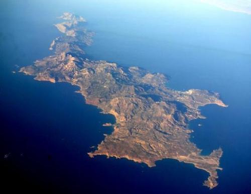
Karpathos, together with the islands of Kassos, Saria and Armathia forming a small archipelago, is the second largest island of the Dodecanese after Rhodes. Dódeka means 'twelve' in Greek, so Dodecanese means 'twelve islands'. In reality, however, there are hundreds of islands and islets in this part of the Aegean Sea, south of the northern Aegean islands and east of the Cyclades, which is called the Carpathian Sea. The sea east and south of Karpathos is called the Libyan Sea, southwest of Karpathos is the Cretan Sea.
Apart from many uninhabited rocky islands, the Dodecanese consist of about 170 larger islands, of which 18 are inhabited. The 'big' islands of the Dodecanese are Rhodes (1398 km2), Karpathos (301 km2), Kos (290 km2) and Kalymnos (109 km2). The total territory of the Dodecanese amounts to approximately 2714 km2.

Karpathos is located exactly between Rhodes and Crete. The distance from Karpathos Town to Rhodes Town is 159 km as the crow flies; the distance from Karpathos Town to Heraklion on Crete is 189 km as the crow flies. Karpathos itself is about 50 kilometres long, 10 kilometres wide and has an indented coastline of about 140 kilometres. The surface area of Karpathos is approximately 301 km2, which makes the island slightly larger than Kos (290 km2).
South-east of Karpathos, only 6 km away, is the practically treeless rocky island of Kassos, the southernmost island of the Dodecanese. Kassos, with the capital Fri, has an area of 66 km2 and has about a thousand inhabitants. The coast of Kassos is very rocky, with the rocky slopes running steeply towards the Mediterranean Sea.
The small, uninhabited island of Saria is located, at a distance of only 200 metres, just north of Karpathos. The highest point of Saria, the Pachy Vouno, is 630 metres.
Landscape
Karpathos is a mountainous island, the highest peak is the Kali Limni in the middle of the island with an altitude of 1215 metres. In the north there is Profitis Elias with an altitude of 719 metres, in the south Chamali with an altitude of 685 metres. The south coast, with the Afiartis plain, is relatively flat. The Korifi Mountains, which are up to 700 metres high, separate the rugged north from the fertile and greener south. Near Olympos are the mountains Orkili (715 m), Kymaras (700 m), Stehoi (640 m), Malo (635 m), Koryfi (590 m), Oros (570 m) and Asia (540 m).
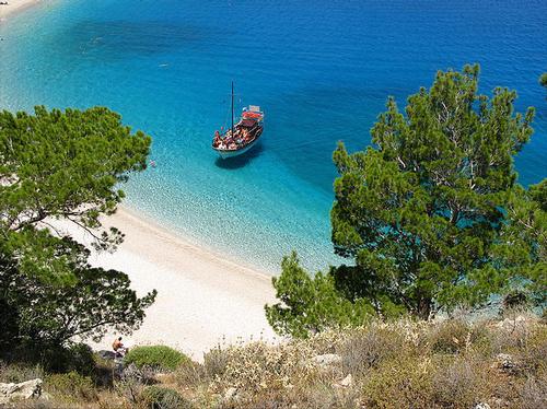
Karpathos has the reputation of being a dry and rocky island with few forests. But Karpathos is also known for its wild and varied landscape with beautiful pine forests, olive trees, small winding roads, coves with pristine white beaches and clear waters. The coast of Karpathos has three faces: the west coast is covered with pine trees, the north coast has a desolate and rough landscape, in the east the coast is rocky and steep with alternating creeks and cliffs.
 Arbella-beach, KarpathosPhoto: Ufoncz CC 2.0 Generic no changes made
The island of Kassos is known for its many caves, including the Ellinokamara Cave and the Selai Cave.
Sources
Wikipedia
CIA - World Factbook
BBC - Country Profiles
Copyright: Team The World of Info