CORFU
Geography and Landscape

Geography and Landscape
| Basic information | |
| Official language | Greek |
| Capital | Corfu Town |
| Area | 593 km² |
| Population | 39,330 (2021) |
| Currency | euro (EUR) |
| Web | .gr |
| Code. | GRC |
| Tel. | +30 |

Popular destinations GREECE
| Aegina | Alonissos | Andros |
| Chios | Corfu | Crete |
| Hydra | Kalymnos | Karpathos |
| Kefalonia | Kos | Lefkas |
| Lesbos | Mykonos | Naxos |
| Paros | Patmos | Peloponnese |
| Poros | Rhodes | Samos |
| Santorini | Skiathos | Skopelos |
| Spetses | Thasos | Zakynthos |
Geography and Landscape
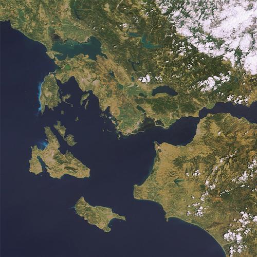
Ionian Islands
The Ionian Islands are located along the west coast of Greece and, with the exception of Kythera, all lie in the Ionian Sea. In the north you will find Corfu or Kerkyra. A little further south is Paxos, followed by Lefkada, Ithaki, Kefalonia and Zakynthos. South of the Peloponnese is the remote island of Kythera, which is usually also included in the Ionian Islands. The seven largest islands are also called "Eptanissa" or "Seven Islands". In total, there are 32 Ionian Islands of which 13 are inhabited. The Ionian Islands have a total area of 2270 km2 and a population of 160,000.

The Ionian islands (except for Kythera) are mountainous and further characterised by the green landscape, many colourful flowers and pleasant temperatures. The highest mountain is on Kefallonia, the Enos with 1627 metres. The Ionian Islands are located in a seismically active area. The islands of Kefallonia, Ithaki and Zákynthos lie at the intersection of three tectonic plates which, for example, in 1948 and 1953, caused earthquakes that resulted in great damage and more than 600 deaths. Southeast of Zákynthos is the greatest depth of the Mediterranean basin: 5090 metres.
Geography Corfu

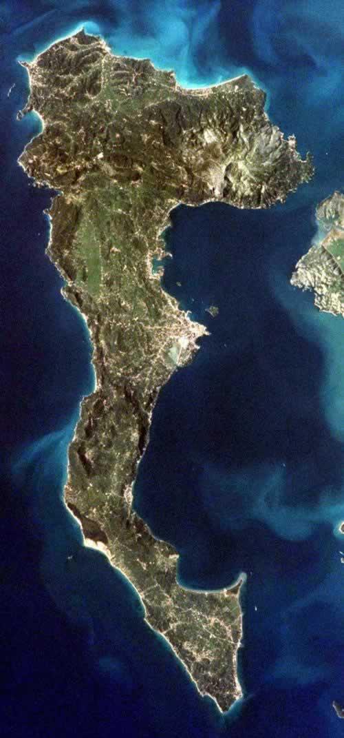
Corfu or Kérkyra is located north-west of mainland Greece and belongs to the Ionian Islands. The island is close to the east coast of Greece and the north (Cape Stéfanos) is only a few kilometres from Albania. To the west of Corfu is the "boot" of Italy. Corfu is situated in the Mediterranean Sea and in particular in the part called Ionian Sea. The Otranto Strait connects the Ionian Sea with the northern Adriatic Sea.
About 200 million years ago, Corfu was cut off from mainland Greece. This created a strait that is only three kilometres wide in the north and 20 kilometres wide in the south.
The total land area is 593 km2, making Corfu the sixth largest island in Greece. Of the Ionian Islands, only Kefalonia is larger than Corfu. Its length from north to south is 62 kilometres and at its widest the island is 28 kilometres, at its narrowest 3.5 kilometres. The southernmost point of Corfu is Cape Asprókavos, 100 metres high and 47 kilometres north of Corfu Town. The total length of the coast is 217 kilometres.
Around the island are some small islands, often no more than rocks. North of the capital Kérkyra or Corfu City are the larger islands, Lazaretto, Vidos and Ptychia. North of Corfu are the smaller islands of Othoni, Erikoussa and Manthraki, which can be reached by boats.
Landscape Corfu
From east to west, two mountain ridges run across the island, effectively dividing it into three.
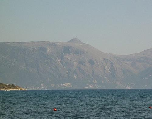
The north of Corfu is mountainous with two limestone mountains. In the northeast lies the Oros Mountains with the highest peak on the island, the Pantokrator (906 metres), which sometimes has a small snow cover in winter. In the northwest lies the Gyros Mountains with the Arakli (505 metres). Between the mountains and the sea is a coastal plain.
 Pantokrator, highest mountain on CorfuPhoto: Florival fr CC 3.0 Unported no changes made
The central part of Corfu is called Mesi and has a varied landscape of hills with small and large plains in between. The highest peak in this area is Agii Deka (576 metres). Northwest of Kérkyra, between the east and west coast, lies the fertile Ropa valley. Across this valley flows the Ropa, which flows into the sea at Ermones.
South Corfu or Lefkími consists of flat and undulating lowlands and the Hlomos with its 330 metres rises sharply above the landscape. On the west coast is a large plain containing the island's largest lake, Lake Korissión. This used to be a bay but is now separated from the sea by a strip of land, although in one place there is still a small connection to the sea. The surface of the lake is 5.4 km2. Despite the high rainfall, only a few rivers have year-round rainfall, including the Mesongí and the Lefkími.
The coastline is varied with mountain walls, coves, pebble and sand beaches and cliffs that reach 100 metres in height in the southwest. Corfu has three large lagoons. The Antinióti lagoon on the north coast is in a fairly rugged area, with animals and plants in the water and surrounding reed beds. In the Halikiopoulos lagoon, south of Corfu city, an airport has been built, but otter families can still be found there. The southern Korissión Lake is home to ibis and avocets, among others, and is a popular hunting ground.
Sources
Desypris, Y. / 777 schitterende Griekse eilanden
Uitgeverij Michalis Toubis S.A.
Fürst, F. / Corfu
Het Spectrum
Gerrard, M. / Korfoe
Van Reemst
Hendriksen, B. / Korfoe en de Ionische eilanden : Paxos, Lefkáda, Kefaloniá, Itháka en Zákinthos
Van Reemst
Webb, S. / Corfu & the Ionians
Lonely Planet
CIA - World Factbook
BBC - Country Profiles
Copyright: Team The World of Info