CANADA
Climate and Weather

Climate and Weather
Cities in CANADA
| Montreal | Ottawa | Vancouver |
Popular destinations CANADA
| Alberta | British columbia | Manitoba |
| New brunswick | Newfoundland and labrador | Northwest territories |
| Nova scotia | Nunavut | Ontario |
| Prince edward island | Quebec | Saskatchwan |
| Yukon |
Climate and Weather
General
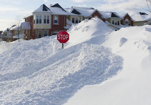 Consequences of a Blizzard in Ottawa,CanadaPhoto: John Talbot (CC BY 2.0) no changes made
Canada is known for its long cold winters, but in reality it has a very varied climate. Southern Ontario and the southern and central coasts of British Columbia are the warmest, Central and Northern Canada have the coldest winters.
The climate of Canada is determined by the following factors:
a) the relatively warm Koero Shiwo current along the west coast, giving Western Canada a temperate climate reminiscent of that of northwestern Europe.
b) the Rocky Mountains, which are an obstacle to moderate western maritime air currents but, on the other hand, cannot penetrate cold polar air to the west coast either.
c) the great plains east of the Rocky Mountains, to which cold, high-latitude air currents have free access.
d) presence in the north of the Arctic Ocean.
e) the cold Labrador current, which flows south along the east coast, making it much colder there than along the west coast.
The lowest winter temperatures are found in the Northwest Territories and Yukon and in the areas east of the Rocky Mountains, where the cold Arctic air can penetrate unhindered. The west coast (including Vancouver) has a much softer climate than the east coast, even in places located on the same or even lower latitude (including St. John's and Halifax).
Precipitation levels are roughly the same on both coasts, with a slightly more even distribution over the year on the east coast due to depressions migrating along the coast. There is relatively little rainfall in the center and north of the country, partly due to the natural barrier that forms the Rocky Mountains.
The central provinces of Canada have a clear continental climate with an average maximum temperature of 26 °C even in the width of Florence. In the Northwest Territories, the annual difference between summer and winter temperatures tends to be above 45 °C. Furthermore, the annual differences in temperature along the west coast are significantly smaller than along the east coast.
According to the Köppen climate system, most of Canada has a boreal (arctic) or snowforest climate. The tundra climate prevails in the north of the country, especially on the Canadian islands. Furthermore, a steppe climate sometimes occurs east of the Rocky Mountains. Finally, along the west coast there is a narrow strip with a moderate rainforest climate.
The air over Canada is usually of polar or arctic origin. Between these two air types there is a sharp transition along which depressions can develop, which then travel across the country from west to east. In the summer, maritime tropical air from the Gulf of Mexico sometimes penetrates into Canada. Many depressions also develop along the front between this air and the polar air. These then migrate along the east coast of the United States to the northeast and give a lot of rainfall in the east of Canada (including St. John's). The above-mentioned depressions migrating from west to east usually produce less rainfall, due in part to the descending movement of the air on the east side of the Rocky Mountains.
Powerful descending blow dryer winds are called chinooks here. The effect of these chinooks is clearly reflected in the temperatures, eg Banff in Alberta at 1378 m altitude with an average January temperature of -11 °C, against the lower but further away from the mountains Winnipeg with -17 °C.
Other special weather phenomena are the blizzards or barbers, as they are called in Eastern Canada. These are snow storms that occur at very low temperatures in winter during and after arctic air inflow at great speed. This air then even penetrates into the Gulf of Mexico and is called "cold waves" there. A blizzard is also called 'poudrerie' because it blows the powder snow.
Fog often occurs along the coasts of Labrador and Newfoundland, especially during the summer months, due to the low temperature of the water of the Labrador Current. Ice fog occurs quite frequently in the winter months. Ice fog are atmospheric ice crystals that form at very low temperatures.
Climate description by province
ALBERTA
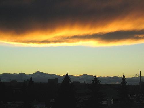 Chinook windPhoto: Surrealplaces CC 3.0 Unported no changes made
Alberta has an extreme continental climate. The north has cool summers and the south warm summers. The average annual temperature ranges from 3.5 °C in the north along the border with the Northwest Territories to 7.0 °C along the border with the United States.
Due to the "Chinook", a strong descending blow dryer blow from the west, the climate in Southwest Alberta is dry and sunny in summer. During a chinook, the temperature can shoot up tens of degrees in a short time. On average, the Chinook occurs about six times every winter. Alberta has cold winters in the north, where the first snow often falls at the end of October and in January the temperature drops to -30 °C. In the south of the province this is even more -10 °C.
Summers are short but warm, with little rainfall in the Southeast as the natural barrier of the Rocky Mountains. During the summer, the temperature in Alberta is between 22 and 25 °C. The number of sunshine hours is 1900 in the north to 2300 in the vicinity of Lethbridge in the south.
Precipitation ranges from 300mm in the southeast to 400-450mm in the north. 550-600 mm falls at the foot of the hills.
BRITISH COLUMBIA
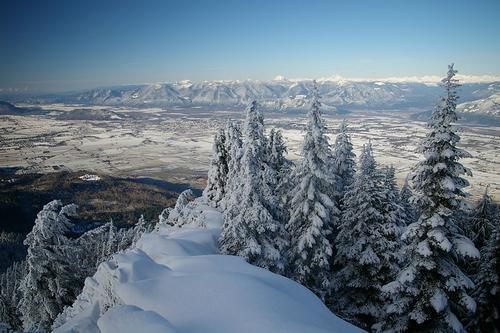
British Columbia has a varied climate due to the influences of the Pacific Ocean with its warm wave currents and the high mountains.
Summers on the south coast are warm and sunny, up to a maximum of approx. 25 °C. The temperature is pleasantly tempered by sea breeze. In winter it rains regularly and minimum daytime temperatures are around freezing. In the summer there are rainstorms and in the winter it can snow for a long time in Vancouver or on Vancouver Island. Every year there is about 2000 mm of rainfall in this area.
The climate in the Okanagan Valley is heavily influenced by the mountainous coast, which separates this region from the Lower Mainland. The mountains ensure that cool air from the valley does not penetrate in summer and cool air is supplied from the polar region in winter. In summer there is therefore little rainfall (average 310 mm per year) and it is very warm. The extreme temperatures are between -18 °C in winter and 32 °C in summer. Some parts are so dry that one can speak of desertification, complete with cacti and rattlesnakes.
The climate in Southeast British Columbia is determined by mountain ranges. The valleys have a humid, mild climate in winter and in the summer it is warm during the day and cool at night. Locally, large precipitation amounts fall here up to 4000 mm per year.
Central and Northern British Columbia have temperature differences that are becoming increasingly extreme. For example, the Peace River district has extremes between -29 °C and 27 °C. The arctic influences in the northeast are clear, cold winters with a lot of snow and short, cold and wet summers. In winter there is an average of 55 centimeters of snow here.
MANITOBA
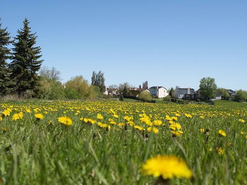
The climate in Manitoba is generally characterized by warm, sunny summers and cold winters. In July and August the temperature rises to approx. 25 °C, but in the middle of winter the temperature remains below freezing point. The average temperatures in some places are as follows:
| Average January minimum | Average July maximum | |
| Brandon | -19.7°C | 18,8°C |
| The Pas | -22.7°C | 17.7°C |
| Thompson | -26.6°C | 15.6°C |
| Churchill | -27.5°C | 11.8°C |
In Manitoba it is warmer in the south and cooler in the north than, for example, in the neighboring province of Saskatchewan.
The reason for this is that the Hudson Bay creates a less extreme land climate. The highest temperature ever recorded is 33.9 °C. In 1964 the temperature dropped to -45.4 °C.
The climate in Manitoba can vary a lot: from 30 °C in summer to -40 °C in winter. On average, especially in the south of the province, more than 100 cm of snow falls annually (Winnipeg 126 cm, Brandon, 117 cm). Most snow falls in northeastern Manitoba, east of the Bissett-Churchill line, and in the Duck and Riding Mountains, approximately 160 cm per year. More than half of all rainfall falls in the summer, often in brief heavy showers. The south of Manitoba has an average of many hours of sunshine per year, which is normal for a prairie area.
NEW BRUNSWICK
 Grande-Anse New BrunswickPhoto: New Brunswick Tourism CC 2.0 Generic no changes made
New Brunswick has warm summers and cold winters. January is the coldest month and July the warmest. Along the Fundy coast, the temperature in summer is between 20 and 22 °C. These temperatures are reached around eleven o'clock in the morning. Then the sea breeze rises and the temperature drops considerably.
Inland, the influence of the sea gradually decreases and the temperatures in summer rise to above 25 °C, incidentally to about 35 °C. The highest temperature ever recorded was 39.4 °C in 1935.
In winter, temperatures drop significantly, from an average -12.2 °C in January in Edmunston, to -7.5 °C along the southeast coast. In the northwest, temperatures above -30 °C are no exception. The lowest temperature ever recorded in this county was −47.2 °C near Plaster Rock in 1955.
As far as winter temperatures are concerned, it is noteworthy that these can vary a lot per day. This is due to the varied, fast-moving weather systems every two or three days.
The number of frost-free days also differs considerably. 140-160 frost-free days per year along the Fundy coast, fewer than 90 frost-free days per year in the central highlands of Miramichi.
New Brunswick is the snowiest Maritime province. In the northwest, between 300 and 400 cm of snow falls annually, in the east and south between 200 and 300 cm. The snow stays on average 160 days in the northwest. Spring and early summer are the driest periods, but there is a lot of rainfall during the growing season. Inland, in the higher areas, 1200 mm fall annually, especially during the summer period. Elsewhere in the province, an average of about 1000 mm falls annually.
Thunderstorms with strong winds occur throughout New Brunswick about 10-20 days a year. Tornadoes are rare and cause little damage. Storms due to passing low pressure areas can occur all year round, but more frequently in the winter period. These storms are often accompanied by a lot of rain or snow. Freezing rain falls on about 12 days a year. Summer and fall storms are common in Fundy Bay and the Northeast.
New Brunswick is home to some of the sunniest places in Atlantic Canada: Chatham records an average of 2,000 hours of sunshine annually, St. John counts nearly 100 hours of sunshine in December, more than anywhere else in Eastern Canada. In July, on the other hand, St. John has the lowest number of hours of sunshine in all of Canada! On average, all of New Brunswick has 75 sunless days and between 140-160 sunny days.
Fundy Bay is one of the most foggy areas in the world. Due to the great contrast between the sea temperature and the passing air, it is foggy in St. John for about 90 days a year, in July even about ten days.
NEWFOUNDLAND & LABRADOR
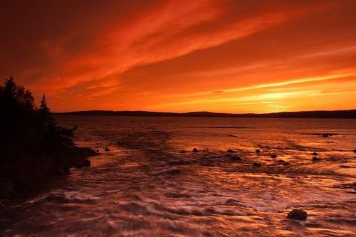 Sunset Newfoundland & Labrador, CanadaPhoto:Michel Rathwell CC 2.0 Generic no changes made
Newfoundland and Labrador also have a varied climate, although the climate is generally colder than in the other provinces on the east coast. Newfoundland has a moderate maritime climate while Labrador has a cold and dry continental climate. Newfoundland's east and south coasts are often foggy. The ordinary fog in Newfoundland is often so heavy that the fog lingers despite a strong wind. Another fog phenomenon is the so-called arctic sea smoke, oversaturated cold air in which condensation occurs. This fog layer can reach a thickness of several meters and is very common. Fog at very low temperatures is called ice mist.
Despite its location by the sea, the weather can vary greatly from day to day in winter. Fierce cold raids alternate with short thaw periods, and this is usually accompanied by heavy snowfall (tens of centimeters in a short time), sleet and strong winds, often even blizzards or blizzards. Every year there is almost twice as much rainfall as in the Netherlands, in the coastal area of Newfoundland often in the form of black ice. Freeze disasters are no exception in Newfoundland. Freezing rain with strong winds is called "ice storm".
The average summer temperatures in Newfoundland are between 15 and 22 °C, the average winter temperatures from -5 to 0 °C, with occasional peaks upwards. The average summer temperatures in Labrador are between 10 and 15 °C, the average winter temperatures between -10 and -25 °C. In February, the mean minimum temperature is -8.7 °C and the maximum temperature is -1.4 °C.
NORTHWEST TERRITORIES
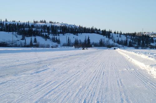 Ice road on Great Slave Lake, North West Territories, CanadaPhoto: Hyougushi CC 2.0 Generic no change
The NWT have a harsh climate. About seven months a year the temperature drops below freezing and at the height of winter it freezes an average of 32 degrees.
It is of course the coldest in the north. In Melville at 76 degrees north latitude, near the magnetic north pole, the annual temperature averages -17.7 °C. In the winter it freezes on average 38 degrees and in the summer it is around 6 °C.
It can also get very hot in the NWT; temperatures of 36 °C have been measured at Fort Providence and Fort Simpson. The lowest measured temperature has been measured in Shepard Bay with -57 °C, but this is also an exception.
The soil is frozen all year round, the so-called permafrost. Summer snow occurs, but is not common. To the north, the amount of precipitation decreases sharply, on the north coast only 60 mm fall annually.
NOVA SCOTIA
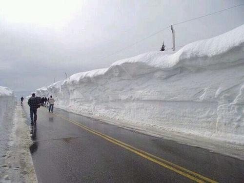 Snow wall Cape Breton Highlands, Nova Scotia, CanadaPhoto: Public domain
The maritime climate of Nova Scotia is of course strongly influenced by the St. Lawrence Gulf in the north, Fundy Bay in the west and the Atlantic Ocean in the south and west.
The water of the Atlantic Ocean and Fundy Bay is relatively cold (8-12 °C), keeping it cool in the southwest in the summer. In January, the temperature is tempered by the same water. The east, south and southeast has to do with the Warm Gulf Stream (16 °C). From January through March, the waters of the St. Lawrence Gulf and Northumberland Strait are covered with ice.
The average temperature along the coast in January is -4 to -6 °C. Summers are relatively cool, around 20 °C along the coast and inland to 25 °C.
The wettest place in Nova Scotia is Cape Breton Island with approx. 1600 mm of precipitation per year. The southern coastal region also receives approx. 1550 mm of precipitation per year. The north coast of the Northumberland Strait receives less than 1000 mm of rainfall annually.
Precipitation falls a little more often in late autumn and early winter. Approx. 15% of all precipitation falls as snow in Nova Scotia, on Cape Breton Island 30%. Along the warm Atlantic coast and around Fundy Bay, a total of about 150 cm falls in winter, about 250 cm inland. The higher elevations such as the Cobequid Mountains and the Cape Breton Highlands receive more than 300 cm of snow per year. The snow periods (period with more than 2.5 cm of snow) differ considerably: 110 days along the south coast and 140 days inland.
Snowfall extremes:
in one winter: 653 cm in Cheticamp, 1964-1965
in one month: 224 cm in Cheticamp, 1961
in one day: 69 cm in Yarmouth, 1885
Halifax has a deserved reputation for being a foggy city. Halifax International Airport has approximately 122 fog days per year. Other "foggy" cities are Yarmouth (118 days), Canso (115) and Sydney (80). Mid-spring to early summer is the foggiest time.
Due to the many fog days, the number of sunny hours is of course disappointing, between 1700 and 1969 hours per year. July is the sunniest month inland, August on the coast. The number of sunless days (less than 5 minutes per day) is 75-90 per year, especially in the period November-February. The number of sunny days is 130-160 per year, especially in the period July-October.
NUNAVUT
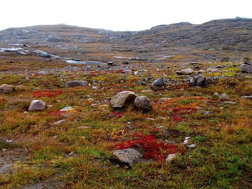
Nunavut has a tundra climate. The tree line separates the continental climate from the Northwest Territories. This tree line also roughly coincides with the permafrost line.
In winter it freezes in Nunavut between 30 and 40 °C, and in summer the temperature rises to 11 degrees in the south. On average, there is a frost-free period of about 50 days, but sub-zero temperatures remain possible every day. The city of Eureka has an average of 271 ice days per year, Alert even about 287 per year (the temperature does not rise above freezing during the day). Most snow falls in October and November and for about eight months the ground in Nunavut is covered with snow.
Most precipitation falls in the summer in the form of wet snow and rain. In the south the quantities are about 400 mm per year, in the northern tundra around Eureka only about 68 mm per year.
It is noteworthy that Alert has 0.03 storm days per year on average, which means that there has only been one thunderstorm in the past thirty years.
ONTARIO
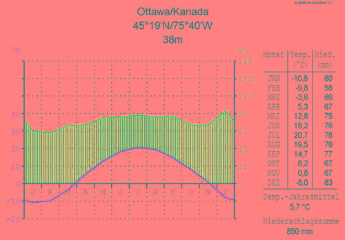 Climate Graphic OttawaPhoto: Hedwig in Washington CC 3.0 Unported no changes
Southern Ontario has a humid climate with long, warm summers and mild winters due to the moderating influence of the Great Lakes.
In the north of the province there are cold winters and sunny, warm summers with cool nights.
The average annual temperature ranges from 2-3 °C in the south to about -4 °C in the far north of the province. Several locations share the record for maximum temperature, 42.2 °C (Atikokan, Fort Frances and Biscotasing). In the south, summer temperatures of over 35 °C are no exception.
On the other side of the thermometer are places like Central Patricia, Hornepayne, White River and Geraldton with minima below -50 °C. Iroquois Falls holds the record with -58.3 °C.
Ontario has more rainfall than the western states. Every year in the east of the province falls about 800 mm. The precipitation is spread over the whole year. Around Hudson Bay it is less sunny with 1700 hours of sunshine every year due to the easy formation of fog and low-hanging clouds.
The amount of rainfall varies greatly from year to year and from place to place. In general it can be said that the amounts of precipitation from the northwest to the southeast increase. For example, the Big Trout Lake area receives approx. 600 mm of precipitation per year, the Marathon / White River region approx. 900 mm and Thunder Bay just over 700 mm. Most precipitation falls in the months of May to September. A period of long-term drought does not actually occur. Winters with more than 400 cm of snow in some areas are quite normal. Searchmount, east of the Upper Lake or Lake Superior, easily reaches 430 cm.
Thunder Bay is the sunniest place in Ontario and even all of eastern Canada with just over 2,200 hours of sunshine a year.
Toronto is located relatively south and is influenced by the lakes in the area, which means that the average temperatures are not too bad. In winter, Toronto usually has a thin layer of snow and temperatures drop an average of 10 degrees below zero; in summer it is around 27 °C daily, making Toronto one of the warmer places in Canada, along with Montreal in the province of Quebec.
PRINCE EDWARD ISLAND
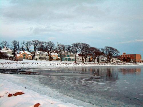 Winter in Charlottetown, CanadaPhoto: Public domain
Prince Edward Island is surrounded by water, which of course has a major influence on the climate of this province. Winter is often boisterous in character, but milder than in the rest of Canada. Spring is cool and summer is moderately warm with a lot of wind. There are hardly any height differences, so that does not affect the climate.
The waters around Prince Edward Island freeze from January to late April, and drift ice occurs until May.
Prince Edward Island has the most varied day-to-day weather in all of Canada. This is due to the different weather systems that rarely last long. These weather systems alternate between polar, sea, continental and tropical air. These air currents come from the Arctic Pacific, the Atlantic Ocean and the Gulf of Mexico.
Due to clouds, fog and mists, the number of hours of sunshine is slightly lower than in the rest of the country. Fog is especially common in spring and summer, the rest of the year is virtually fog-free, unlike counties such as Newfoundland and Nova Scotia.
Summers are quite cool with an average July temperature of approx. 18.5 °C and daily maximum temperatures of up to approx. 25 °C. Temperatures above 30 °C are rare and the highest temperature ever recorded is 37.8 °C.
Winter temperatures are affected by the ice that surrounds Prince Edward Island in the winter. However, temperatures above -15 °C are rare. The frost-free period is between late May and early October, and lasts no longer than 130 days.
There is precipitation all year round, on average about 1000 mm per year in the southeast and 1100 mm in the middle of the island. Most precipitation falls from late autumn to early winter. The island has between 130 and 160 rainy days per year, of which 30% with snow. Prince Edward Island is one of the snowiest areas in Canada. After St. John and Québec-City, Charlottetown is Canada's third "snow city" with approximately 330 cm of snow a year.
The wind blows harder on average than in the other Maritime Provinces, especially in the winter months, when it often storms. Tornadoes, severe thunderstorms and hail storms are rare.
The island often suffers from Atlantic storms, which cause tidal waves, strong winds and heavy rainfall. Sometimes a tail from a passing hurricane causes the island and then brings a lot of rainfall. On September 22, 1942, 163.8 mm of rain fell in Charlottetown, a record on Prince Edward Island.
Winter storms approaching the hurricane level (+ 100 km / h) and causing heavy rain or snow can plague the island for days. Freezing rain and snow can easily shut down public life on the island for days.
QUEBEC
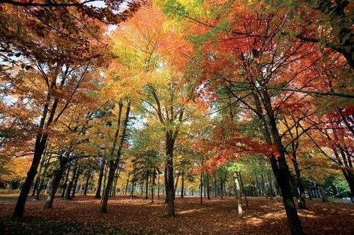
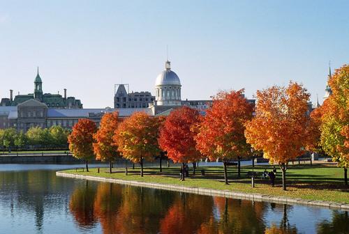 Autumn colours in Montréal, QuebecPhoto: AnnaKucsma CC 2.5 Unported no changes made
Quebec has warm summers, but spring and fall are the best time to visit Quebec. Winter in Quebec can be very cold, especially in the exposed countryside in the east, where even ice storms can occur.
The climate has many outliers, especially in winters. The weather can then vary greatly from day to day. In the north of Quebec there is a tundra climate with average maximum temperatures of 15 °C in summer, and average minimum temperatures of 20 °C below zero in winter.
Most of the precipitation falls in summer, but in winter it falls only a few tens of millimeters, usually in the form of snow. Annually, an average falls between 400 and 500 millimeters.
More to the south, in winter the average maximum temperature is 10 °C below zero. The rainfall here is significantly higher than in the north, about 800 mm per year.
Montreal is located far inland and clearly benefits from its southern location in summer with average maximum daytime temperatures of 26.4 °C in summer.
SASKATCHEWAN
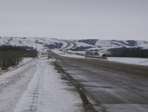 Winter landscape Lumsden, Saskatchewan, CanadaPhoto: Victor D in the public domain
Saskatchewan has an extreme continental climate that is not affected by seas or oceans. In the boreal north this is accompanied by cool summers, in the southern prairie climate with warm summers. Due to the large temperature differences in winter and summer, the average annual temperature varies from 3.5 °C in the north to 7.0 °C in the south against the border with the United States.
Saskatchewan is one of the counties with the least rainfall and the most hours of sunshine. The south of Saskatchewan has 2300 hours of sunshine a year and is therefore significantly sunnier than the Dutch De Bilt with 1477 hours. In winter, temperatures can drop as low as -50 °C, while in short summers, temperatures can rise to 30 °C again, with peaks reaching 40 °C in the south of the province. Normally, the daily values during the summer months are between 22 and 25 °C. Due to these large temperature differences, the average annual temperature is lower than anywhere else in the world at the same geographical latitude.
Both in the north and in the south there is little rainfall, although in the prairie region even less than in the northern arctic region. The Pacific air is already dry when it arrives in Saskatchewan. The air from other directions is also dry. As a result, Saskatchewan not only has little rainfall, but also a lot of sunshine. Estevan is the "Sunshine Capital" of Canada with an average of 2540 hours of sunshine per year.
No description of the climate in Saskatchewan is complete without the blizzards, prairie storms that last about six hours and often occur in February. Public life is often disrupted.
YUKON TERRITORY
Yukon Territory Whitehorse Sled DogsPhoto: Public domain
Yukon has a very dry climate. It rains little (about 300 mm per year) and there is an average of 28 centimeters of snow per year. In the hot summers, Yukon has long days with lots of sun; in the northern part of Yukon, the sun never even completely sets in the month of June.
Average temperatures in the hottest month of July range from 14 °C in the southern Whitehorse to 16 °C in the northern Dawson City. Outliers above 30 °C remain possible in this province as well.
In winter it averages -16 °C in Whitehorse and -27 °C in Dawson City. Outliers down to -51 °C are possible in the winter period. Whitehorse has an average of 120 ice days per year (days when the temperature does not rise above freezing). In December, both cities have less than six hours of daylight.
The south of Yukon is affected by the warm Gulf Stream. Humid air and warmth from the ocean then regularly penetrate to the center of Yukon. The northern Inuvik on the Beaufort Sea is just as warm in summer as in the Netherlands. In July it is around 20 °C here.
The lowest temperature ever recorded in Canada was -63 °C at Snag on February 3, 1947.
Sources
Canada
The Reader’s Digest
Canada
Cambium
Heetvelt, A. / Canada
ANWB
Ivory, M. / Canada
Kosmos-Z&K
Jepson, T. / Canada
Van Reemst
Njio, F. / Canada
Kosmos-Z&K
Roy, G. / North Canada
Bradt Wal, C.P.F. van der / Canada van A tot Z : praktische informatie over wonen en werken in Canada
DEN, Stichting Dienstverlening Emigratie Nederland
Weber, Wolfgang R. / West-Canada : Alberta, British Columbia
Lannoo
Zuilen, A.J. van / Gids voor Canada
Gottmer
CIA - World Factbook
BBC - Country Profiles
Copyright: Team The World of Info
