BURGUNDY
Geography and Landscape

Geography and Landscape
| Basic information | |
| Official language | French |
| Capital | Dijon |
| Area | 31.582 km² |
| Population | 1,631,000 (2019) |
| Currency | euro (EUR) |
| Web | .fr |
| Code. | FRA |
| Tel. | +33 |

Popular destinations FRANCE
| Alsace | Ardeche | Auvergne |
| Brittany | Burgundy | Cevennes |
| Corsica | Cote d'azur | Dordogne |
| Jura | Languedoc-roussillon | Loire valley |
| Lot | Normandy | Picardy |
| Provence |
Geography and Landscape
Geography
The Burgundy region is located southeast of Paris. With an area of almost 32,000 square kilometers, the region is about the same size as Belgium. The Côte d'Or department covers 8765 km2, Nièvre 6,815 km2, Yonne 7,425 km2 and Saône-et-Loire 8,575 km2. Burgundy is bordered on the north by Champagne, on the east by Savoy and Franche-Comté, on the south by Beaujolais and Lyonnais and on the west by the Loire Valley.
Landscape
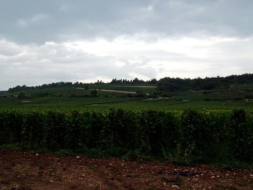
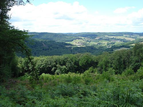
 Burgundy LandscapePhoto: Tara Hunt CC 2.0 Generic no changes made
Burgundy has a true mosaic of characteristic landscapes, but mainly has gently sloping hills (between 150 and 600 meters) and wide river valleys. Only the Morvan is a bit more mountainous with peaks of up to 900 meters, including the Mont Beuvray (821 m) and the Bois du Roi (902 m).
Burgundy can be divided into four different areas. In the east lies the wide river plain of the Saône. The north and west consist of fertile plains that together form the sedimentary basin of Basse-Bourgogne, around the towns of Auxerre and Chablis.
In the center are limestone plateaus that end in steep slopes in the east, Arrière-Côte and Côte. To the south lie granite masses and plateaus of the beautiful, hilly nature reserve Parc Naturel Régional du Morvan, and further the Charolais and the Mâconnais.
Burgundy is a very wetland area. The Marne, the Aube, the Ource, the Seine, the Ozerain, the Armançon, the Serein, the Cure, the Yonne and the Loire flow in a northerly direction with their side branches that flow partly to the south such as the Arconce, the Bourbince, the Arroux and the Nièvre. The Saône runs south, with its tributaries flowing northwards, the Ouche, the Dheune and the Grosne.
In the 19th century, the main rivers were linked by a number of canals: Canal de Bourgogne (between Yonne and Saône), Canal de Center (between Loire and Saône), Canal du Rhône au Rhin and Canal de la Marne à la Saône.
Parc Naturel Régional du Morvan

This is one of 23 regional nature parks in France. The total area is 175,000 hectares, of which 70,000 hectares is occupied by forests (mainly beech, oak, pine, spruce) and 1300 hectares by water.
In 1970, 64 municipalities were included in this national park. The Morvan covers an area of 50 km in width and 70 km in length and consists roughly of two parts: La Bas-Morvan and Le Haut-Morvan. At 855 m, Mont-Préneley is the highest point in Burgundy.
The Morvan has some large forests: Forêt de la Gravelle (2000 ha), Forêt Le Bois du Roi (1013 ha), Forêt domaniale d'Anost (1695 ha), Forêt domaniale au Duc (1227 ha) and Forêt domaniale de Breuil- Chenue (1113 ha). The Morvan has an extensive network of rivers, the most important of which are the Cure, the Chalaux, the Cousin, the Ternin and the Yonne.
Sources
Bourgondië
Lannoo
Bourgondië, Jura
Michelin Reisuitgaven
Bussmann, K. / Bourgondië : kastelen, kloosters, en kathedralen in het hart van Frankrijk
Cantecleer
Evers, K. / Bourgondië
Gottmer
Frankrijk : natuurreisgids
Cantecleer
Keuning, T. / Bourgondië, Champagne
ANWB
CIA - World Factbook
BBC - Country Profiles
Last updated June 2025Copyright: Team The World of Info