NEW ZEALAND


Cities in NEW ZEALAND
| Auckland | Christchurch | Wellington |
Geography and Landscape
Geography
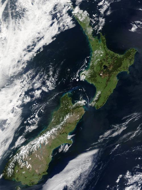
New Zealand (officially: Dominion of New Zealand), is a constitutional monarchy in the Pacific, a member of the Commonwealth and a part of the continent of Oceania.
The total land area is 267,515 km2. The total coastline is 15,134 kilometers. New Zealand includes the North Island (115,000 km2 and in Maori: Maui), the South Island (151,000 km2 and in the Maori: Pounamu), Stewart Island (1,735 km2), the Chatham Islands (963 km2) and a number of smaller uninhabited islands (total 320 km2) such as, Campbell, Bounty, Antipodes, Auckland, Snares and Kermadec.
In addition, there are overseas territories under the jurisdiction of New Zealand, the Tokelau Islands and the Ross Dependency in the Antarctic, and the self-governing overseas territories of the Cook Islands and Niue Island.
New Zealand is about the same size as Great Britain. Australia is 2,200 kilometers away and the two countries are separated by the Tasman Sea. Cook Strait is located between North and South Island. Foveaux Strait is located between South Island and Stewart Island.
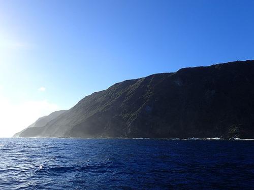
The northernmost point of New Zealand is the Surville Cliffs on the North Island. The southernmost point is the southwestern cape of Stewart Island. The distance between these two points is about 1600 kilometers. The maximum width is approximately 450 kilometers on the North Island. New Zealand is located exactly halfway between the Equator and the South Pole. Wellington is the southernmost capital in the world. Surville Cliffs, most northern poit of New ZealandPhoto: LawrieM CC 4.0 International no changes made
About 100 million years ago, New Zealand became detached from the Australian portion of the supercontinent Gondwana, which included South America, Antarctica, Africa and Australia. New Zealand is now on the border of the two largest tectonic plaice in the world. Australian plaice is home to North Island and the western part of South Island. On the Pacific plaice are the eastern and southern parts of South Island. Approx. For 10 million years, the two schools moved over each other and the mountains were formed on South Island. Most of the hills and mountains on North Island are of volcanic origin. Several islands off the coast of South Island are also of volcanic origin. Mountain formation continues to occur due to volcanism and the movement of the two plaice past each other, and light and heavy earthquakes regularly occur.
Landscape
Three-quarters of New Zealand's surface is above 200 meters. Furthermore, the North and South Island are mountainous. The highest peak is Mount Cook (3764 meters) in the New Zealand Alps on the South Island. Other high mountains are Mount Dampier (3440 meters) and Mount Tasman (3499 meters). In total there are 223 peaks with altitudes of more than 2300 meters. Spread across North Island are impressive crater cones: Mount Egmont (2518 meters) on the west coast, extinct and heavily forested; to the east the still working Ruapehu (2797 meters), the Ngauruhoe (2291 meters), sometimes with steam and gas operation, and the Tongariro (1986 meters). The last major eruption of the Ruapehu dates from 1997. There are a number of spectacular glaciers in the Southern Alps. The Southern Hemisphere's largest glacier outside of Antarctica is the Tasman Glacier which is over 28 kilometers long. The Franz Josef Glacier and the Fox Glacier cover an area of over 4,000 hectares.
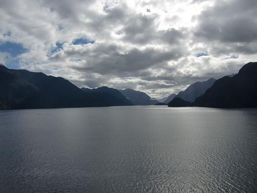
The coastlines are fairly regular in shape with only a few deep fjords on the west coast of South Island. The Dusky Sound is the longest fjord in the country. These fjords were created after rising sea levels, when the ice age valleys were flooded. In this area is also the Sutherland Waterfall which plunges 580 meters down. The west coast of the North and South Island has high sand dunes, spectacular rock formations and cliff-like coasts. Dusky Sound, longest fjord of New ZealandPhoto: Gérard Janot CC 3.0 Unported no changes made
The South Island also contains the so-called Punakaiki Pancakerocks, a name that speaks for itself. The east coast of both islands is characterized by sometimes beautiful sandy beaches and beautiful bays and the sea here is much calmer than on the west coast. In the subtropical north of the Bay of Islands are the most beautiful sandy beaches of New Zealand and also about 150 small, mostly uninhabited islands.
Many glacial valleys have been filled with rain and melt water since the ice ages. As a result, there are some large lakes in the Southern Alps and Fiordland, including the lakes Pukaki, Wanaka, Wakatipu and Manapouri. There is still a very active central zone around the large Taupo Lake. In addition to short-term lava effluent, there are many boiling springs in this "pumice" -covered plain up to 600 meters high. Lake Hauroko is the deepest lake in New Zealand (462 meters).
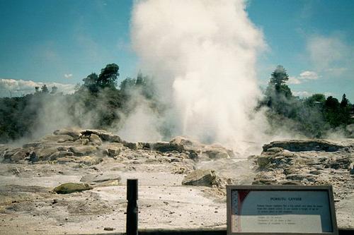
Plenty Bay is home to the highly active White Island volcano, where high ash clouds are constantly thrown into the air. Whakarewarewa Park features many spouting geysers, boiling mud pools, hot springs and steaming rock formations. The largest hot water lake in the world is located in the Waimangu Thermal Valley. The geyser Lady Knox sprays at a quarter past ten to heights of more than twenty meters. The largest geyser in New Zealand is the "Pohutu", which spouts a 30-meter fountain. The many rivers are all short and often not navigable due to the large decline, but are therefore very suitable for hydroelectric power generation, especially in connection with the numerous high-altitude lakes, which serve as a water reservoir.
 Pohutu geyser, New ZealandPhoto: Carl Lindberg CC 3.0 Unporte no changes made
The longest river in the country is the Waikato River (425 km) on the North Island. The longest navigable river is the Whanganui River, also on the North Island. New Zealand also has fantastic cave systems to offer. On the North Island, for example, the Waitomo Caves and on the South Island, the glowworm caves of Te Anau and the Ngarua Caves.
Sources
Driessen, J. / Reishandboek Nieuw-Zeeland
Elmar
Gebauer, B. / Nieuw-Zeeland
Lannoo
Gebauer, B. / Nieuw-Zeeland
Elmar
Hanna, N. / Nieuw-Zeeland
Kosmos-Z&K
Harper, L. / New Zealand
Rough Guides
New Zealand
Macmillan
Te gast in Nieuw-Zeeland
Informatie Verre Reizen
Williams, J. / New Zealand
Lonely Planet
CIA - World Factbook
BBC - Country Profiles
Copyright: Team The World of Info