SLOVENIA
Geography and Landscape

Geography and Landscape
| Basic information | |
| Official language | Slovenian |
| Capital | Ljubljana |
| Area | 20.256 km² |
| Population | 2,079,438 (2021) |
| Currency | euro (EUR) |
| Web | .si |
| Code. | SVN |
| Tel. | +386 |
Cities in SLOVENIA
| Ljubljana |
Geography and Landscape
Geography
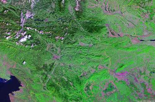
Slovenia (Slovenian: Slovenija; officially: Republika Slovenija), is a republic in the Balkans in Central Europe. Slovenia was the northernmost republic of the former Yugoslavia until independence in 1991. The total area of the country is 20,273 km2. Slovenia is therefore one of the smaller states in Europe.

Slovenia borders Austria (330 km) to the north, Hungary (102 km) to the east, Italy (232 km) to the west and Croatia (670 km) to the south and southeast. Slovenia also has a coastline that borders the Adriatic Sea (46.6 km). Southwest of Slovenia lies the Croatian peninsula of Istria, which borders Slovenia in the north and is virtually surrounded by the Adriatic Sea.
Landscape
Slovenia is generally mountainous with peaks above 2500 meters in the center and northwest of the country. More than 90% of the country is above 300 meters and the average altitude is 600 meters.
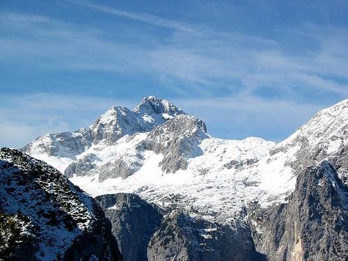
In the northwest are the Kamniške Alps and the Julian Alps with Slovenia's highest mountain, Triglav (2864 meters). Triglav means "three heads", named after the shape of this mountain. The Triglavski narodni park is located around the Triglav.
Other high mountains are:
Škrlatica 2738 meters
Mangart 2677 meters
Jalovec 2643 meters
Razor 2601 meters
Rjavina 2530 meters
 Triglav, Slovenia's highest mountainPhoto: Andrejj CC3.0 Unported no changes made
To the southeast the landscape descends and we find hilly plains and wide plateaus (1000-1500 meters). Along the northern border of Slovenia and south of the Julian Alps are mountain ranges such as the Karavanken (above 2000 meters) and the Trnovski gozd (above 1500 meters). East of the Karavanken are the densely forested foothills of the Austrian Noric Alps (up to 1542 m)
The east of Slovenia is becoming flatter and turns into the Pomurje and the Pannonian Plain, which is mainly located in Hungary. In the south and southeast it is hilly in the basin of the Sava and Krka.
Caves, lakes and rivers
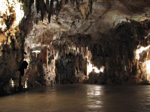
 Caves of Postojna, SloveniaPhoto: Nadia Petkova CC 3.0 Unported no changes made
The south and southwest of the country, between the capital Jubljana and the Gulf of Trieste, is famous for the numerous caves or “jamas” that have formed in the porous limestone rocks there. This so-called “Karst” area includes cave systems that are among the most imposing in the world, including those of Postojna Jama and Škocjanske Jama. The Postojna cave system is approximately 20 kilometers long. In total there are about 7000 caves known throughout the country and the deepest goes 1.3 kilometers into the ground.
Some other famous caves are:
- Pivka Jama in the area of Postojna
- Planinska Jama near the village of Planina, north of Postojna
- Lokavska Jama in the area of Lipica
- Kostanje-viška Jama near Kostanjevica, east of Novo Mesto
Some karst phenomena are:
- stalagmites: dripstone cones with the point upwards
- stalactites: hanging dripstone cones
- dolinas: funnel or bowl shaped recesses
- poljes: fertile places in the karst area that are flooded in the rainy season: sometimes these poles expand into enormous lakes, including Cerknica and Planina
- carts: grooves on the surface created by attrition of the water.
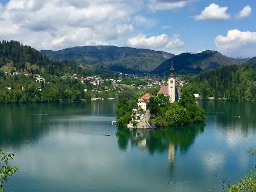
 Lake Bled, SloveniaPhoto: Anna & Michal CC 2.0 Generic no changes made
The lakes Bled, Bohinj, Triglav and Krn are beautifully situated. The total length of all streams and rivers is approximately 26,000 kilometers. The longest river in the country is the Sava. It has its source in Ratece, a stone's throw from the Italian border, and runs through the north and the center of the country to Croatia. Other important rivers are the Soèa in the west, the Drava or Drau in the north, the Mura and the Kupa. There are also many freshwater sources, of which about 7,500 are known. Several hundred guarantee excellent mineral water.
Slovenia's coast is rocky and has no natural sandy beaches.
Sources
Buma, H. / Reishandboek Slovenië
Elmar
Derksen, G. / Slovenië, Istrië (Kroatië)
Gottmer
Wilson, N. / Slovenia
Lonely Planet
CIA - World Factbook
BBC - Country Profiles
Copyright: Team The World of Info