PICARDY

Popular destinations FRANCE
| Alsace | Ardeche | Auvergne |
| Brittany | Burgundy | Cevennes |
| Corsica | Cote d'azur | Dordogne |
| Jura | Languedoc-roussillon | Loire valley |
| Lot | Normandy | Picardy |
| Provence |
Geography and Landscape
Geography
Picardy is a northern French region with its capital in Amiens. Picardy is located northeast of Normandy. The surface of Picardy is 19,399 km².
Picardy borders the region of Haute-Normandie to the west, Nord-Pas-de-Calais to the north, Champagne-Ardennes to the east and Ile-de-France to the south. In the north-west of Picardy, there is a short coastal strip of approx. 75 km bordering on the English Channel.
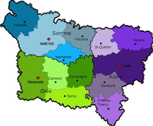 Picardy MapPhoto: Public Domain
Landscape
In the north of Picardy, between the towns of Amiens and Saint-Quentin, lies the Picard plateau, which connects the flat region of Santerre and the more hilly Vermandois. On average, Picardy is fairly flat with an average height of only 98 metres. The highest point in Picardy is in the Aisne department near the town of Watigny and measures 295 metres. The Picardy plateau is crossed by the Somme and consists mostly of a farming landscape with extensive farmland interspersed with forest areas.
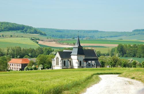 Typical Picardy Landscape, BouttencourtPhoto: Isamiga76 CC 2.0 Generic no changes made
Between the plateaus of Ile de France and Picardy, there are three hill regions: Laon, Noyonnais, Clermontais. In the north-east of Picardy, the Thiérache is a coulisse landscape with mainly woods and meadows. In the west, partly in Normandy, is the small (750 km²) Pays de Bray, with a bocage landscape suitable for the development of grassland and thus for the breeding and keeping of dairy cattle. A bocage landscape is a small-scale landscape type, characterised by small meadow parcels that are screened by hedges consisting of hawthorn, willow, blackthorn and hornbeam, or walls
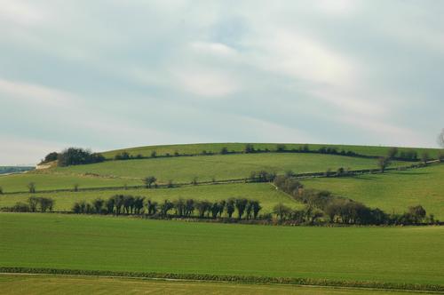 Bocage landscape in the Pays de Bra, PicardyPhoto: Isamiga76 CC 2.0 Generic no changes made
A steep hill dominates the landscape of Noyonnais, it is the mountain of Noyon. The Noyonnais offers a hilly landscape covered with trees and is also the area of cattle, sheep and pig farms as well as fruit and vegetable crops, including many red fruits such as strawberries and cherries.
The Vimeu, located in the far west of Picardy and south of the Baie de somme, is a green region bordered by two valleys, that of Bresle in the south and that of the Somme in the north. This region is characterised by a lot of grassland and hedges.
Approximately 17% (= ca. 320,000 ha) of the Picardian landscape is covered with mainly (mixed) oak and beech forests. The department of Aisne has the Forêt de Retz (13,000 ha), the Forêt de Saint-Michel (5000 ha with maples and ash trees) and the forests of Saint-Gobain and Coucy (12,000 ha). These latter forests are home to many different species of trees, including many poplars.
The department also has impressive forests, e.g. in Compiègne (14,400 ha0 and Trs-Forêts of Chantilly, Ermenonville and Halatte (18,000 ha).
The department of Somme has as important forest area only the 4323 ha oak- and beech forest Forêt Domaniale de Crécy.
Rivers and lakes
Artificial lake Lac de L'ailette - Aisne 140 ha
Lac de Gouvieux
Lac de la Haut Somme
Lac des Ciments
The Picardian coast is a strip of about 75 kilometres with alternating chalk cliffs and sandy beaches. The landscape is very varied, a rocky coastline, beautiful sandy beaches, large forest areas, extensive fields and meadows, vast plateaus with huge fields dominate the image of the region.
Several rivers flow through the region, such as the Somme, which can be seen as the natural border between France and Flanders, the Authie, the Aisne and the Canche. At the point where the Somme River reaches the coast, the fresh water of the Somme meets the salty sea water. This meeting makes the Baie de Somme very sensitive to low and high tides. The Baie de Somme covers an area of 37,900 ha, a third of which is a nature reserve. Besides the Somme, the small river Maye also flows into the sea. Beaches and sandbanks that are submerged at high tide are called 'vasières'; sandbanks lying deep in the estuary, usually dry, are called mollères (salt marshes) and are populated by grazing sheep.
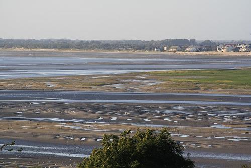 Baie de Somme, PicardyPhoto: Madame29D CC 4.0 International no changes made
The Aisne rises in the Argonne massif and flows into the Oise near Compiègne, after a 360 km journey through the departments of Meuse, Marne, Ardennes, Aisne and Oise. Tributaries of the Aisne are Aire (143 km), Retourne (45 km), Suippe (101 km) and Vesle (140 km). From Celles-sur-Aisne onwards, the river has been canalised and is navigable for vessels with a maximum load capacity of 400 tonnes, a maximum length of 38.5 metres and a maximum width of 5.05 metres.
The Somme rises near Fonsomme in the Aisne department and flows into the Bay of the Somme in the English Channel after approximately 245 kilometres. The main tributaries of the Somme are the Avre (66 km) and the Ancre (38 km). From Abbeville onwards, the Somme has been canalised.
Over a length of 156 km, the Somme Canal runs parallel to the Somme since 1827 and connects the towns of Saint-Simon and Saint-Valery-sur-Somme. At the moment, the canal is only used for pleasure cruises.
The Oise rises near the southern Belgian town of Chimay and, after more than 300 km through the Paris basin, joins the Seine near Conflans-Sainte-Honorine in the Yvelines department. The Oise flows 105 km through Picardy, from Thiérache to Creil, passing through four departments in total: Aisne, Oise, Val-d'Oise and Yvelines. After the Marne, the Oise is the most important tributary of the Seine; the most important tributaries of the Oise itself are the Serre (96 km) and the Aisne (360 km).
Important for inland navigation will be the Canal Seine-Nord or Liaison Seine-Escaut, through which barges up to 4400 tons and three layers of containers can pass, up to six times bigger than today. The canal will connect the industrial regions around the Seine and the Scheldt, and should bring economic benefits to France, Wallonia and Flanders as well as the Netherlands and Germany. The new canal will be 106 km long and runs between the Seine and the Scheldt near Cambrai in northern France. From its opening in 2027, large inland navigation vessels will be able to sail directly from the Western Scheldt to Paris.
The canal will cost at least some 6-8 billion euros, is a project of De Vlaamse Waterweg nv with the support of the European Union, and work is expected to start in the first half of 2020. The actual construction work already started in 2005 in Evergem, just north of Ghent, where a new lock complex has been built.
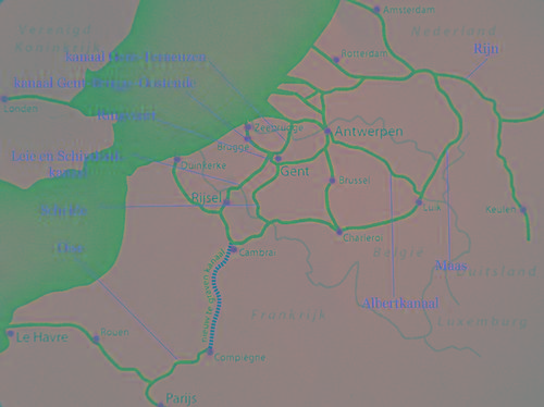
Canal Seine-Nord, which runs through PicardyPhoto: Paul Hermans CC 3.0 Unported no changes made
Climate and Weather
The climate of Picardy is comparable to the climate of the England. Because of the more southern location, it is a degree warmer. The sea has a big influence on the climate. The summers are not very warm with temperatures around 21 degrees Celsius. Winters are generally mild with temperatures around 6 degrees Celsius. Precipitation falls all year round. Characteristic for Picardy is the alternation of good and bad weather.
The average daily temperature is 16.5 °C in the summer and 3.2 °C in the winter. In Amiens, the sun shines 1600 hours per year. The average monthly rainfall is 53 mm in the summer and 51 mm in the winter; the annual average is 687 mm.
Amiens climate chart
| daytemperature | nighttemp. | hours sunp/d | rainy duays | |
| january | 5°C | 0°C | 2 | 11 |
| february | 6°C | 1°C | 3 | 9 |
| march | 9°C | 2°C | 4 | 11 |
| april | 13°C | 4°C | 5 | 10 |
| may | 17°C | 8°C | 6 | 10 |
| june | 20°C | 11°C | 7 | 10 |
| july | 22°C | 12°C | 7 | 11 |
| august | 22°C | 12°C | 7 | 10 |
| september | 19°C | 10°C | 5 | 9 |
| october | 15°C | 7°C | 4 | 12 |
| november | 9°C | 3°C | 2 | 13 |
| december | 6°C | 1°C | 2 | 12 |
Plants and Animals
Plants
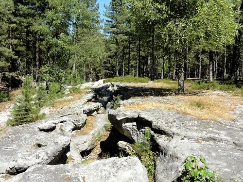 Forest of Retz, PicardyPhoto: P Poschadel CC 3.0 no changes made
Originally, this part of France was completely covered with forest. Even today, there are two large areas of forest in Picardy, near Compiegne and near Retz. They are deciduous forests with many oaks, beeches, maples, ash, birches and chestnuts. Along the coast, there are dunes with hellebores and pine trees. Furthermore, there are many meadows on the limestone soils with wild flowers, including orchids.
Animals
In France, Baie de Somme is the most important habitat for a colony of seals, about 300 common seals and about 100 grey seals or conger seals. Just off the coast of the towns Fort-Mahon-Plage and especially Le Hourdel, the seals can often be found on sand banks.
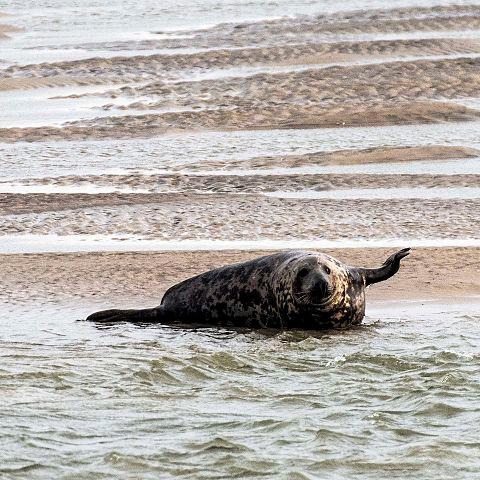 Seal on a sandbank off the town of Fort Mahon Plage, PicardyPhoto: Tomfo CC 4.0 International no changes made
Important for the bird population is the Parc du Marquenterre, a 250 ha large protected nature reserve. There are about 344 bird species living here (in the whole of Europe, there are about 650 species), supplemented by many migratory birds throughout the year.
In the Somme, there is a lot of eel, but also carp, perch, pike and tench are abundant.
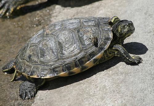 Letter turtle PicardyPhoto: Francesco Canu CC 3.0 Unported no changes made
In 2016, a spider census was held in Picardy. 432 species were counted.
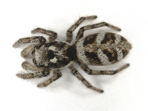 Spider PicardyPhoto: B. Schoenmakers CC 3.0 Unported no changes made
A horse species that is typical for the Baie de Somme area is the 'Cheval de Somme' or Henson horse. The species, small with a shoulder height of approx. 1.55 m, is a cross between warm-blooded French riding horses and cold-blooded Norwegian fjord horses and has only been bred since the 1970s. Due to their great stamina, they are extremely suitable for use in the tourist industry.
Since 2003, the horse has been officially recognised by the French Haras Nationaux, the national public administrative body responsible for regulating and managing the breeding of horses and donkeys in France. In 2010, the Haras Nationaux, together with the École Nationale d'Éducation, the national riding school, became part of the new Institut Français du Cheval et de l'Équitation.
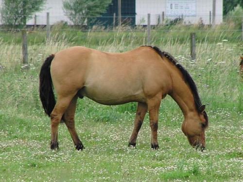 Cheval de Somme, horse breed from PicardyPhoto :Eponimm CC 3.0 Unported no changes made
Sources
BBC - Country Profiles
CIA - World Factbook
Heetvelt, Angela / Picardië : Nord-Pas-de-Calais
ANWB
Picardie : Somme-Oise-Aisne
Lannoo
Wikipedia
Copyright: Team The World of Info