ANGOLA
Geography and Landscape

Geography and Landscape
| Basic information | |
| Official language | Portuguese |
| Capital | Luanda |
| Area | 1.246.700 km² |
| Population | 33,933,610 (2021) |
| Currency | kwanza (AOA) |
| Web | .ao |
| Code. | AGO |
| Tel. | +244 |
Geography and Landscape
Geography
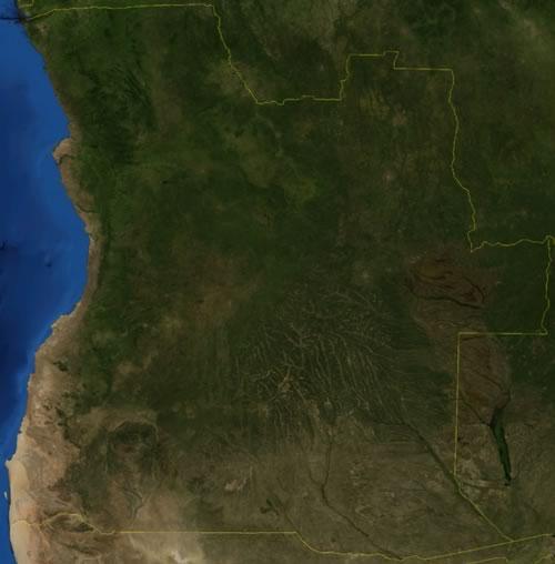
Angola is located in the southwest of Africa, south of the equator, and is bordered to the north by the Democratic Republic of Congo (Congo-Kinshasa, 2421 km, excluding Cabinda) and the Republic of the Congo (Congo-Brazzaville, 231 km), in the south at Namibia (1427 km) and in the southeast at Zambia (1065 km). In the west, Angola borders the Atlantic Ocean with a coastline of approximately 1,650 km. The vast country stretches inland for about 960 kilometers.
Bordering the Atlantic Ocean, the Cabinda exclave is an Angolan province sandwiched between the Democratic Republic of the Congo to the south and east and the Republic of the Congo to the north. The former Portuguese protectorate (Portuguese Congo) has an area of 7270 km².
The area of Angola is 1,246,700 km². Worldwide, 23 countries are larger than Angola, in Africa there are only six countries, Algeria (2,381,741 km²), Democratic Republic of Congo (2,344,858 km²), Sudan (1,886,068 km²), Libya (1,759,540 km²), Chad (1,284,000 km²) and Niger (1,267,000 km²), greater than Angola.

Landscape
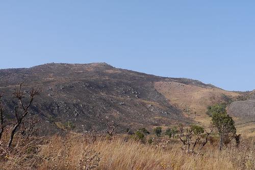
 Highest mountain in Angola Morro de MocoPhoto: Benjamin Stauch in the public domain
The landscape of Angola is mainly characterized by three major landscape types: the low-lying coastal strip, the hills and mountains and a vast plateau. The coastal strip in western Angola ranges in width from just 25 kilometers in the Benguela region to 150 kilometers in the Luanda region in the Cuanza River valley.
East of the coastal strip begins a strip of hills and mountains., about 135 kilometers wide in the north and only 30 kilometers wide in Central Angola and to the south. North of the Cuanza River, the lowlands gradually change into a hilly landscape with a height of about 500 meters. South of the Cuanza River, the landscape rises spectacularly fast to heights of up to 2,400 meters in the Serra da Chela mountain range in Huíla province.
The rest of Angola, about 2/3 of the country, is occupied by the high-altitude Biéplateau, part of the Central African Plateau, which stretches from the south of the Democratic Republic of Congo to Namibia. The average height of the plateau is 1828 meters;the higher parts have an average height of 2500 meters. The highest mountain in Angola is Morro de Moco, located in the province of Huambo, with a height of 2619 meters. Other high mountains in Angola are the Lupangue (2554 m), the Ungungi (2511 m), the Senha (2494 m), Mbuindo (2480 m), Vavele (2479 m), Chalima (2478 m), Catchimanha (2451 m), Tchila (2,442 m) and Sacotiquite (2,438 m).
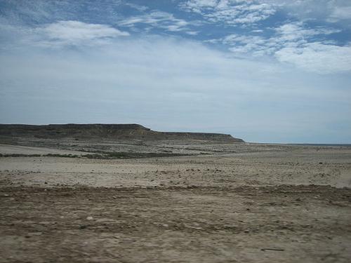
In the southwest of Angola is another offshoot of the Namib Desert or Namib, which extends to the Angolan city of Namibe. The northern part of this desert is also called Kaokoveld Desert and consists of gravel plains, hills, valleys, sand dunes and sand plains. Namib desert in AngolaPhoto: Erik Cleves Kristensen CC 2.0 Generic no changes made
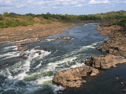
 Angola's longest river is the CuanzaPhoto: Jlrsousa CC 2.0 Generic no changes made
Angola has a network of rivers, most of which originate in the mountain region. The country's main rivers are the Cuanza (Kwanza) and Kunene (Cunene). The Cuanza flows to the north, the Kunene to the south, but both eventually flow into the Atlantic Ocean. The Cuanza is the longest (950 km) river entirely in Angola. The Kunene (1050 km) forms in the south of Angola the border with Namibiaa and never dries up in summers with normal rainfall, unlike most other rivers of Angola.
The Cuanza is navigable from the coast for transport purposes for a little over 200 kilometers, the other rivers of Angola are hardly usable for that purpose, but are used for irrigation and hydroelectricity, among other things. Other important rivers of Angola are the Cubango, Cuando, Cassai, Cuito and Chicapa. The border with the Democratic Republic of Congo is formed by the mighty Zaïre (aka Congo).
Sources
BBC - Country Profiles
CIA - World Factbook
Elmar Landeninformatie
Oyebade, Adebayo / Culture and customs of Angola
Greenwood Press
Stead, Mike / Angola
Lonely Planet
Copyright: Team The World of Info