ENGLAND


Cities in ENGLAND
| Birmingham | Liverpool | London |
| Manchester |
Popular destinations UNITED KINGDOM
| England | Northern ireland | Scotland |
| Wales |
Geography and Landscape
Geography
Great Britain and Northern Ireland or the United Kingdom of Great Britain and Northern Ireland (officially: United Kingdom of Great Britain and Northern Ireland; abbreviation: UK), is formed by an island group in northwestern Europe.
The United Kingdom includes the former kingdoms of England and Scotland and the former Principality of Wales, all located on the island of Great Britain. Northern Ireland therefore also belongs to the United Kingdom, but is located on the island of Ireland. There are also a number of well-known and lesser known islands (groups) including: the Orkney Islands and the Shetland Islands in the north, the Hebrides in the west, Anglesey and Man in the Irish Sea, Wight and the Channel Islands in the Channel.
The Channel Islands and the Isle of Man are not part of the United Kingdom under constitutional law, but fall directly under the British Crown. European Union legislation does not generally apply to these islands either.
To complicate matters further, when the British islands are referred to in literature or in the media, they mean Great Britain and Ireland.
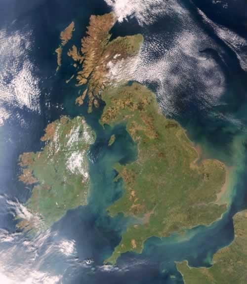
The total area of England is 130,422 km2, which is 54% of the area of the United Kingdom (Scotland 78,800 km2, Wales 20,800 km2, Northern Ireland 14,100 km2). England is therefore about three times the size of the Netherlands. The area of the United Kingdom is 244,122 km2. The United Kingdom is therefore almost 6 times the size of the Netherlands.
England is located northwest of the European mainland and close to France; only 35.4 km separates the coast of England (Dover) from that of France (Calais) via the Strait of Dover.
England forms the southern part of Great Britain, borders Scotland to the north, Wales to the west, the North Sea to the east and the Channel to the south.
East of England is separated by the North Sea from Scandinavia, the Netherlands, Belgium and Northern Germany. Ireland and England are separated by the Irish Sea.
The total coastline of England is 1851 km and no place is more than 121 km from the sea.
England also includes the Channel Islands of Jersey, Guernsey, Alderney and Shark, the Isle of Man, the Isle of Wight, and the Isles of Scilly, including St. Mary's.
Landscape
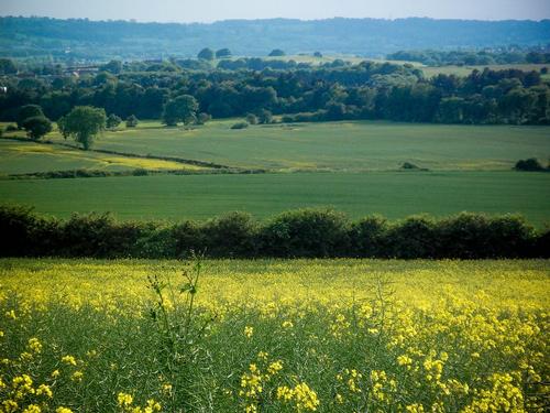 Landscape Nottingham EnglandPhoto: Shamraze/Nuhaize (CC BY 2.0) no changes made
England used to be largely covered with forests. Not much is left of that, except for a few wooded areas such as the New Forest near Southampton and Sherwood Forest near Nottingham.
England's coastal landscape is very varied, from pebble beaches and chalk cliffs in Sussex to extensive sandy beaches in the north of Norfolk. The southwest has white sandy beaches where popular seaside resorts such as Brighton and Blackpool.
Great Britain can be roughly divided into Upland Britain with high plains and mountains and in Lowland Britain with low plains and open fields. England is generally dominated by lowlands. Higher elevations are the Pennine Mountains (up to 640 meters), the Yorkshire Marshes (up to 450 meters), the Cumbria Mountains (up to 1000 meters) and Cornwall (up to 620 meters).
Regions
South East England or the "London countryside" has a varied relief with many trees, forests and parks. The Greater London Basin is surrounded by chalk hills: the Chiltern Hills to the northwest, the North Downs to the south, and the South Downs flowing into gigantic chalk cliffs.
More to the east is the funnel mouth of the Thames with several small bays and creeks on either side.
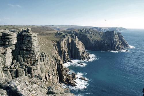 Lands End Cornwall EnglandPhoto: Kevin Law CC 2.0 Unported no changes made
In South West England, the counties of Devon and Cornwall are linked by a granite ridge with high, stony moors and rocky outcrops. The long coast offers a wide variety of landscapes, ranging from impressive rock bastions, bays and sea arms that reach deep inland with wooded banks.
East Anglia has a gently sloping landscape with extensive arable land. East of Norwich are the Norfolk Broads, which has a large number of shallow waters. The marshes and peat area around Wash Bay have turned into arable land.
Lincolnshire and East Anglia barely rises above sea level. This now drained area used to consist mainly of fertile wetlands, better known under the name "The Fens".
The Midlands of central England are bordered to the north and west by the Pennine Mountains and the Welsh mountains. In the south and east there is a vague border formed by wide valleys, rivers with the steep slopes of mountain ranges in the background, including the Cotswolds Hills. Elsewhere, the landscape is more varied with hills, moors and wooded areas.
Northern England is characterized by high moors and rugged mountains. Here lies the Pennine Mountains (Pennines) with extensive plains on both sides, including the Cheshire Plain and the Lancashire Plain. On the east side is a fertile area, which extends northwards into the Vale of York and is bordered by chalk plateaus to the sea. In the far north, the inhospitable Cheviot Hills are the worn-out remains of ancient volcanoes. The Yorkshire Dales has a characteristic chalk landscape with plateaus and high hills with flattened peaks, including the 693 meter high Pen-y-Ghent, but also gorges, rock walls, caves and subterranean rivers.
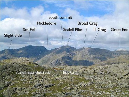
Scafell ridge, with the highest peak in England, Scafell Pike.Photo: Public domain
East of the Pennine Mountains, the North York Moors National Park covers a wide moor. To the west is the Lake District with the highest peak in England, the Scafell Pike of 978 meters. This region has a wide variety of mountain landscapes, from wild rocks to beautiful park landscapes at Windermere Lake.
Rivers and Lakes
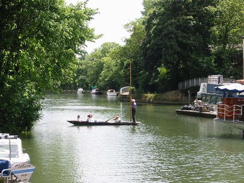 River Thames near OxfordPhoto: Zxb CC 2.0 Austria no changes made
England has a large number of small rivers; the largest, the Thames (Thames), is 336 km long, of which only 280 km is navigable. There are 55 navigable rivers, the main of which are the Thames, Ouse, Trent, Humber, Tees, Wear and Tyne to the east, the Avon to the south and the Severn, Dee and Mersey to the west. Most rivers have a deep bed, are rich in water, have little decay, have a smooth course and are generally easy to navigate.
The lakes, especially in the much visited Lake District, are not large, but often beautifully situated. Lake Windermere (15 km2) is the largest lake in England; another large lake is Ullswater, 9 km2.
The high tide is highest on the west coast; in the Solway Firth and on the Severnmond it reaches a speed of 16 km per hour and a height of 13-14 meters. The flood at the mouth of the Thames is normally less than 5 meters high.
Sources
Allport, A. / England
Chelsea House
Bowden, R. / Groot-Brittannië
Corona
Engeland, Wales
Lannoo
England
Lonely Planet
England
Rough Guides
Fuller, B. / Britain
Marshall Cavendish
Groot-Brittannië
Michelin Reisuitgaven
Locke, T. / Engeland
Van Reemst
Parsons, F.S. / Engeland
Van Reemst,
Schaedtler, K. / Highlights van Engeland en Wales
Gottmer
Somerville, C. / Groot-Brittannië
Kosmos-Z&K
CIA - World Factbook
BBC - Country Profiles
Last updated June 2024Copyright: Team The World of Info