SCOTLAND


Cities in SCOTLAND
| Edinburgh | Glasgow |
Popular destinations UNITED KINGDOM
| England | Northern ireland | Scotland |
| Wales |
Geography and Landscape
Geography
Scotland (English: Scotland; German: Schottland; French: L'Écosse) is the northern part of the island of Great Britain, located in northwestern Europe. The total land area of Scotland, including the many islands, is 77,213 km2 (including inland waterways 78,764 km2). The mainland measures a maximum of 440 km from north to south and 248 km from east to west.
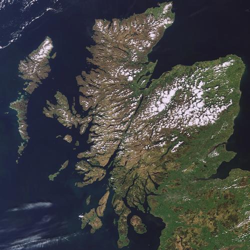
Because the 10,000 km long coast is generally deeply cut, few places are more than 100 km from the sea.
The area includes the former Kingdom of Scotland and is part of the United Kingdom of Great Britain and Northern Ireland. Scotland borders the Atlantic Ocean to the north and west, the North Sea to the east and England to the south.
Landscape
Landscape is generally divided into three areas: The Southern Uplands, the Central Lowlands or Midland Valley and the Highlands, the Scottish Highlands.
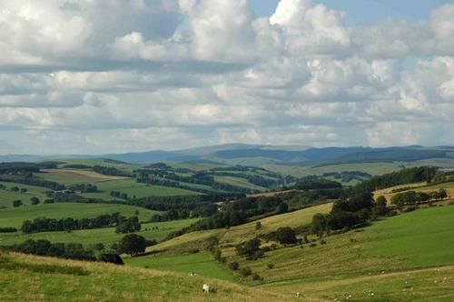 Southern Uplands ScotlandPhoto: Charlie Kennedy CC 2.0 Generic no changes made
The mountains of the Southern Uplands are rounder and not as high as the mountains of northern Scotland. Endless green hills, wooded valleys and fish-rich rivers characterize the landscape. The higher parts consist of flattened "moors".
The hills in the border area between England and Scotland, the Borders and the Galloway hills are mostly no higher than 800 meters. The hills or barren covered or barren hills in the Borders are intersected by valleys of rivers, such as the fish-rich Tweed.
In the southwest are the Galloway Hills where mountains such as the Merrick (843 m), the Criffel (569 m) and the Cairnsmore or Fleet stand out prominently. Galloway also has forests and moors and a rugged coastline.
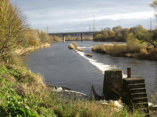 The River Clyde at Carmyle ScotlandPhoto: James Denham CC 2.0 Generic no changes made
Near the Lowther Hills, rivers Clyde and Tweed have their source. The Nith, the Annan and the Esk flow into the Solway Firth. Further east are the Moorfoot Hills and the Lammermuir Hills, which define the Southern Upland Vault fault line. South of this is the Tweed basin. Originating in the Tweedsmuir Hills and ending in England - with part of the lower reaches forming the boundary - the Tweed is the third longest river in Scotland, after the Tay and the Clyde. The main tributaries are the Yarrow, the Ettrick, the Gaia, the Leader and the Teviot.
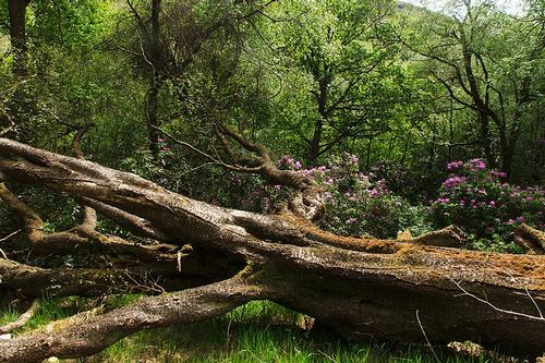 Trossachs National Park ScotlandPhoto: Alexey Komarov CC 4.0 International no changes
The relatively flat Central Lowlands are surrounded by the Southern Upland Fault and the Highland Boundary Fault. The valleys and deltas of the Clyde, Forth and Tray rivers form a fertile strip between the Atlantic Ocean and the North Sea. In most places, the Central Lowlands do not rise above 122 meters, with the exception of mountain ranges such as the Campsie Fells, the Kilpatrick Hills, the Ochil Hills and the Sidlaw Hills. The Lothian Plains are only interrupted by the Pentland Hills, near Edinburgh.
The lowlands extend further from the River Forth and through to the River Tay. Hills like Bass Rock and North Berwick Law are of volcanic origin.
The Trossachs is an area with beautiful "lochs" and "lochans" (inner lakes), "glens" (valleys) and "bens" (mountains). Here is also Scotland's only "lake", the Lake of Menteith, which was given an English name for unknown reasons in the late 19th century.
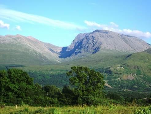 Ben Nevis, highest mountain in Scotland and Great BritainPhoto: Thincat in the public domain
The major part of the Highlands or Scottish Highlands is above 900 meters and consists mainly of deserted peat and heather plateaus. Elongated valleys, deep lochs (lakes) and jagged granite tops alternate. The mountain peaks ("cairns") are often completely isolated and consist mainly of quartz rocks.
The Great Glen Fault fault line runs from the Loch Linnhe estuary to the Moray Firth and separates the Grampian Mountains from the North West Highlands. The Great Glen is a 150-kilometer crack in the Earth's crust and largely filled with lakes. The famous Loch Ness, Loch Lochy and Loch Linnhe lie like a ribbon here in the straight valley.
The Cairngorms cover a vast area above 1067 meters, with peaks such as the Cairn Gorm (1245 m), the Ben Macdui (1309 m) and the Braeriach (1295 m). In the area of the Monadhliath Mountains there are a number of high peaks, such as the Ben Lawers (1214 m) and especially the Ben Nevis (1344 m), the highest mountain in all of Great Britain.
Also here are the freshwater lakes of Loch Lomond (71 km2, the largest inland waterway in Britain), Loch Katrine, Loch Awe and Loch Tay, and Scotland's largest rivers, the Spey, the Tay, the Dee and the Don.
The rugged highlands north and west of the Great Glen Fault have an average elevation of 610 meters, punctuated by some spectacular peaks such as the Suilven (731 m), the Canisp (846 m), the Quinag (808 m), the Ben Hope (927 m) and Ben Loyal (764 m).
Islands
Scotland includes 186 inhabited islands and approximately 600 uninhabited, most of which are off the northern and western coasts.
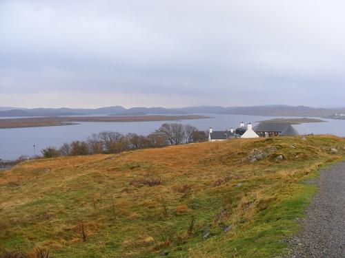 Outer Hebrides ScotlandPhoto: Ben Coulson (CC BY-SA 2.0) no changes made
The very jagged west coast has numerous peninsulas and sea arms, and a long way off the coast are the Inner Hebrides and the Outer Hebrides. The Outer Hebrides is an archipelago 64 kilometers west of mainland Scotland known locally as the "Long Islands". They extend in a 208-kilometer, narrow arc from the headland of Butt of Lewis in the north to Cape Barra Head in the south. The northernmost islands of Harris and the larger Lewis actually form one island. Lewis is mostly flat, but Harris gradually rises to high rocky mountains to the north, with the peak of the 799-meter Clisham as its highest point. Other well-known islands include Barra, Vatersay, Saint Kilda and the Uist islands of North Uist, Benbecula and South Uist.
The islands closest to the mainland are called the Inner Hebrides ("Inner Hebrides"). The Inner Hebrides include islands such as Skye, Mull, Iona and Islay.
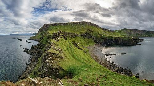 Island of Skye ScotlandPhoto: Colin CC 4.0 International no changes made
The often fog-shrouded island of Skye (Gaelic: Eilean A'Ceo 'misty island') lies off the northwest coast of Scotland and is one of the most beautiful of the Scottish islands, boasting impressive estuaries, rocky peaks and stunning views. It is therefore one of Scotland's most popular tourist destinations. The sea arms cut so deep into the landmass that although Skye is only eighty kilometers long and fifty kilometers wide, not one part of the island is more than eight kilometers from the sea.
The northern part of the Isle of Arran is dominated by mountains of around 800 meters; the southern part of Arran is less mountainous, maximum 450-500 meters. The ridge to the south, the Cuillins, is over 1,000 meters high and extends from Loch Brittle in the west to Broadford in the east. The highest peak is the Sgúrr Alasdair (1085 m).
The Isle of Mull consists of a contrasting combination of high mountains, desolate moors, multiform lakes, elongated valleys, deep coves, smooth sandy beaches and stark rock formations. The highest peak on Mull is the Ben More (968 meters).
Iona was the cradle of Christianity in Scotland. In 563, the Irish missionary Columba landed here from Ireland, and with his twelve followers founded a monastery on Iona, from where they started Christianization of Scotland, England, and later the rest of Europe.
Staffa is known for its columnar basalt formations and large caves, which penetrate deep into it. One of the largest caves is Fingal's Cave (22 meters and 76 meters deep).
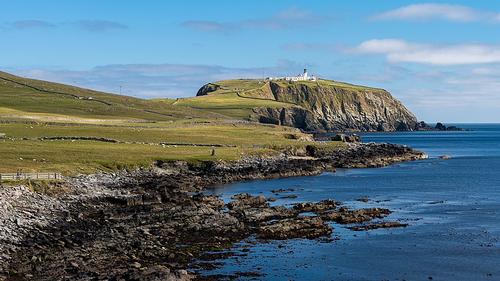 Shetland Islands ScotlandPhoto: Joe de Sousa in the public domain
To the north, above the Pentland Firth, there are two major archipelagos, the Orkney Islands with ninety islands and the Shetland Islands with about a hundred islands (approx. 1426 km2).
The landscape of the Shetland Islands consists mainly of treeless, sparse moor and peat areas, intersected by numerous small lochs. The coast is alternately formed by wild rocks and cliffs or by long sandy beaches. The Shetland Islands are located about 160 km north-northeast of the Scottish mainland, about the same distance as from Norway and only six degrees south of the Arctic Circle. The main islands are Mainland, Yell and Unst.
The Orkney Islands cover a total area of 3,100 km2. Just twelve kilometers separate the northeastern coast from the seventy islands, about a third of which are inhabited. The southernmost island of Orkney is separated from the mainland by the Pentland Firth, which is only 10 kilometers wide. Fair Isle, St. Kilda and Rockall are separate, isolated islands.
The Orkney Islands are mostly sandstone; the barren landscape consists of 85% hilly, fertile agricultural land.
Sources
Berkien, G. / Schotland
Kosmos-Z&K
Berkien, G. / Schotland
ANWB
Larrimore, D. / Schotland
Kosmos-Z&K
Levy, P. / Scotland
Marshall Cavendish
Patitz, A. / Schotland
Van Reemst
Schaff, B. / Schotland
Kok Lyra
Schotland
Cambium
Schotland
Lannoo
Schotland
Michelin Reisuitgaven
Schotland
Van Reemst
Smallman, T. / Scotland
Lonely Planet
Stoks, F.T. / Schotland
Gottmer
Summers, G. / Schotland
Van Reemst
Tschirner, S. / Schotland
ANWB
Wamel, D. van / Schotland en Noord-Engeland
Babylon-De Geus
CIA - World Factbook
BBC - Country Profiles
Last updated June 2025Copyright: Team The World of Info