ALGARVE

Popular destinations PORTUGAL
| Algarve | Azores | Costa de lisboa |
| Costa verde | Madeira |
Geography and Landscape
Geography
The Algarve is the southernmost part of Portugal. To the east, the Algarve is bordered by the Rio Guadiana. This river also forms the border with Spain. In the north the Algarve borders the Spanish province of Alentejo and to the south and west of the Algarve lies the Atlantic Ocean.
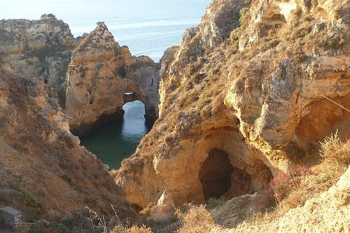
 Algarve Rock FormationsPhoto: Triops 1972 CC 4.0 International no changes made
The total area of Algarve covers more than 6,500 square kilometers. There is a coastline of 170 kilometers. From the coast to the northernmost point is a maximum of 40 kilometers.
Landscape
The landscape of the Algarve is very varied. The coast has the well-known rock formations with small beaches to the west of Faro. Many rocks, caverns and caves formed by water and wind can be found here. East of Faro are lagoons and kilometers of sandy beaches. The coastline is almost completely protected nature reserve (Parque Natural da Ria Formosa). Albufeira, Lagos and Portimao are the somewhat larger coastal towns.
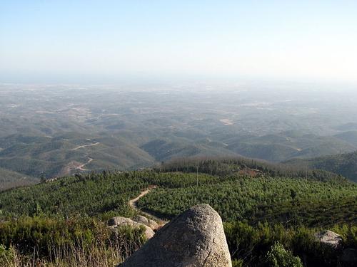
 View from Foia , the highest point in the Algarve Photo: Glen Bowman CC 4.0 International no changes made
The interior of the Algarve is sparsely populated and virtually untouched by tourism. Here you can admire beautiful villages and towns and castles where it seems as if time has stood still. This area is hilly with the highest peak being Foia (902 m) near Monchique.
Sources
Champion,N. / Portugal Corona
Dominicus, J. / Portugal Gottmer
Encarta Encyclopedie
Holisova, J. / Algarve ANWB
Keuning, T. / Portugal ANWB
Wakeren, B. van / Algarve, Zuid-Portugal, Lissabon Gottmer
CIA - World Factbook
BBC - Country Profiles
Last updated January 2026Copyright: Team The World of Info