BELGIUM
Geography and Landscape

Geography and Landscape
| Basic information | |
| Official language | Dutch, French, German |
| Capital | Brussels |
| Area | 30,528 km² |
| Population | 11,632,326 (2021) |
| Currency | euro (EUR) |
| Web | .be |
| Code. | BEL |
| Tel. | +32 |

Cities in BELGIUM
| Antwerp | Bruges | Brussels |
| Ghent |
Geography and Landscape
Geography
Belgium (French: Belgique; German: Belgien) is a federal constitutional monarchy in Northwestern Europe. The total area of Belgium is 30,518 km2 and the capital is Brussels (French: Bruxelles).
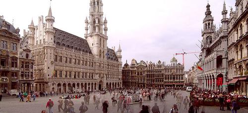
 Brussels Grand PlacePhoto: Mats Halldin CC 3.0 Unported no changes made
Belgium includes about 30 small areas or exclaves located in the Dutch province of North Brabant, which together form the municipality of Baarle-Hertog.
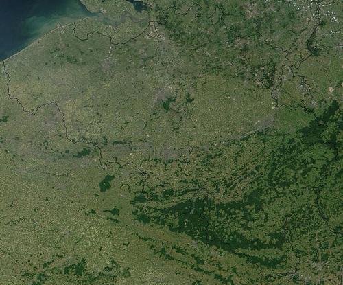
Belgium borders the North Sea in the west (coastline: 66 km), in the north the Netherlands (450 km), in the east the Netherlands (167 km) and the Grand Duchy of Luxembourg (148 km), and in the south France (620 km).

The Walloon Region (French: Région Wallone) is a federal state of Belgium with the capital Namur (French: Namur). The region includes the territory of the provinces of Walloon Brabant, Namur, Luxembourg, Hainaut and Liège. The total area of the Walloon Region is 16,844 km2 and the population is approximately 3,315,000. The region has its own "Walloon Parliament" and its own government, which is based in the regional capital of Namur.
The seven ministers are elected by the Walloon Parliament. The chairman, the prime minister, comes from the government. The government exercises power through decisions and is accountable to parliament. The decisions are published in the Belgian Official Gazette.
The Flemish Region is the other federal state of Belgium with the capital Brussels. The region includes the territory of the provinces of Limburg, East Flanders, West Flanders, Antwerp and Flemish Brabant. The total area of the Flemish Region is 13,522 km2 and the number of inhabitants is approximately 5,900,000. The Flemish Parliament is the legislative assembly for both regional and community affairs, and the Flemish Government exercises executive power.
The government is based in Brussels and has a maximum of eleven ministers. It is elected by the Flemish Parliament. The government elects a chairman, the prime minister, from its members. The government exercises executive power through decisions and, as a college and each of its members, is individually accountable to Parliament. The decisions are published in the Belgian Official Gazette.
Landscape

Geographically, Belgium can be divided into three regions: Low Belgium (up to 100 meters high), Central Belgium (from 100 up to 200 meters high) and High Belgium (from 200 meters up to more than 500 meters high).
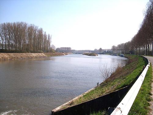
Lower Belgium starts in the west with the coast, a strip of sea, sandy beach and dunes, which extends in a straight line over a distance of approximately 65 kilometers. Behind the coast are the polders, a flat and very fertile land that has been drained and protected by strong sluices against the strong tides.
The Flemish plains lie between the western polders and the rivers Leie and Schelde, a sandy region with some hills here and there. To the east lie the Kempen, a landscape with mainly pine forests, meadows and corn fields.
Central Belgium lies behind the Flemish plains and the Kempen and gradually rises to the Sambre and Meuse valleys. These low loam plateaus form the most fertile soil in Belgium. Brabant is highly urbanized, but the Sonian Forest is still a remnant of the former coal forest, which spread over much of the country in Roman times.
Central Belgium also includes Hainaut in the west and Hainault in the east. These are also fertile regions with extensive fields and meadows.
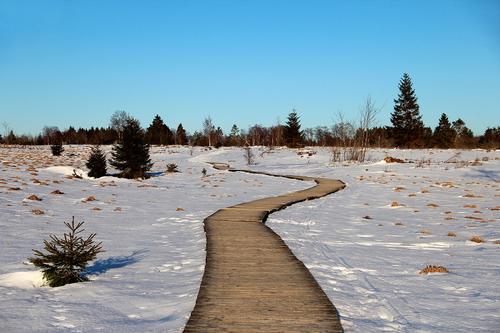
 High Fens BelgiumPhoto: Jean-Pol Grandmont CC 3.0 Unported no changes
High Belgium is sparsely populated and most forests are found here, starting south of the Sambre and Meuse with the Condroz plateau. This fertile region is best known as a tourist attraction with the valleys of the Maas and the Ourthe and the many monuments. Between the Vesder and the Maas lies the land of Herve, which, due to the rich, moist clay soil, is ideally suited for pastures and therefore for cattle breeding.
South of the Condroz is the Fagne and Famenne region; not so suitable for agriculture, but more known for the many caves. South of it are the Ardennes, a very wooded area with natural birch and planted spruce forests, interspersed with plateaus and deep valleys. Spruce trees do well here because of the acidic soil. Here is also the highest point in Belgium: the Signal of Botrange with 694 meters.
The southernmost part of Belgium is Belgian Lorraine with a milder climate than elsewhere in the country and a so-called Cuesta landscape; steep edges created by the alternation of hard and soft layers. There are even vineyards on the southern slopes of the hills.
Sources
Belgium, a way of life
Lannoo
European Union: fifteen country documents
European Platform for Dutch Education
The Stateman's Yearbook: the politics, cultures and economies of the world
Macmillan Press Limited
CIA - World Factbook
BBC - Country Profiles
Last updated June 2025Copyright: Team The World of Info