MADAGASCAR
Geography and Landscape

Geography and Landscape
| Basic information | |
| Official language | French, Malagasy |
| Capital | Antananarivo |
| Area | 587.041 km² |
| Population | 28,907,015 (2021) |
| Currency | ariary (MGA) |
| Web | .mg |
| Code. | MDG |
| Tel. | +261 |

Geography and Landscape
Geography
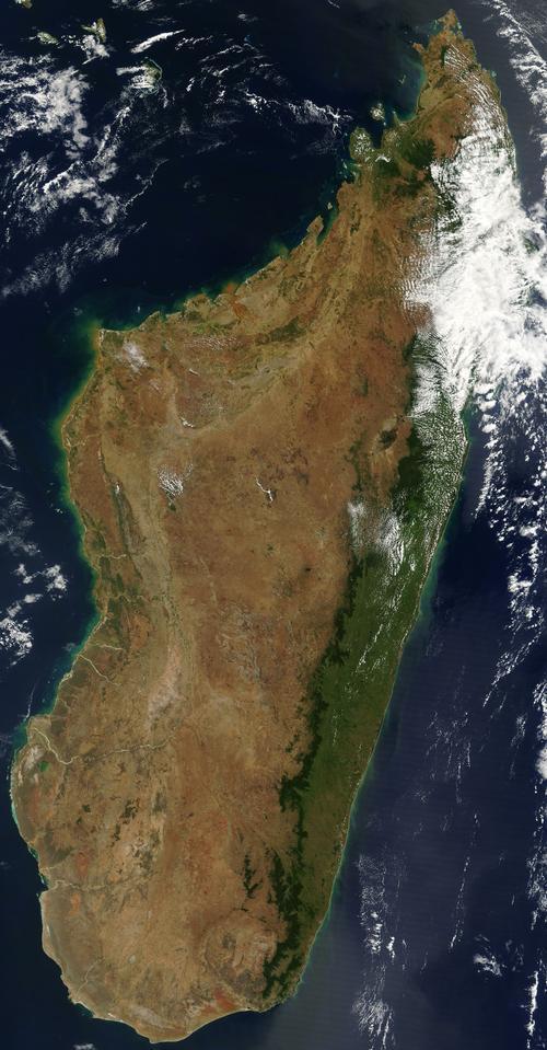
Madagascar (officially: French: République de Madagascar, or Madagascar: Repoblikan 'i Madagasikara) is located 400 km east of Africa's east coast, along the Mozambique Strait. Madagascar is the fourth largest island in the world after Greenland, New Guinea and Borneo. The surface covers 587,041 km² and Madagascar is therefore slightly smaller than France and Belgium combined. From north to south the greatest distance is 1580 km, from east to west the greatest distance is 579 km. The highest point in Madagascar is the Maromokotro, 2876 meters high.

Landscape
Madagascar is also called the "red island", a reference to the reddish brown earth. Madagascar has a very varied landscape because of the central mountain ridge that runs across the island.
To the north is the mountainous region of Montagne d'Ambre with forests full of ferns, palms and other enormous trees.
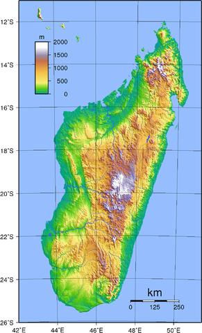
A little further south is the largely volcanic Ankarantra Mountains with many caves, caverns, limestone formations and subterranean rivers. It continues to the north and south with an average elevation of 1500 meters. Madagascar's highest peak is the Maromokotro in the Tsaratanana massif (2876 m). The east coast is tropically humid and you will find tropical rainforests here.
 Height differences in MadagascarPhoto: Sadalmelik in the public domain
The southwestern tip of Madagascar is a very dry desert area with enormous thorn hedges. Between the savannah landscape in the northwest and the desert landscape in the southwest, there is another area with a steppe landscape. In the northwest, the coast has many deep inlets, in front of which are many islands.
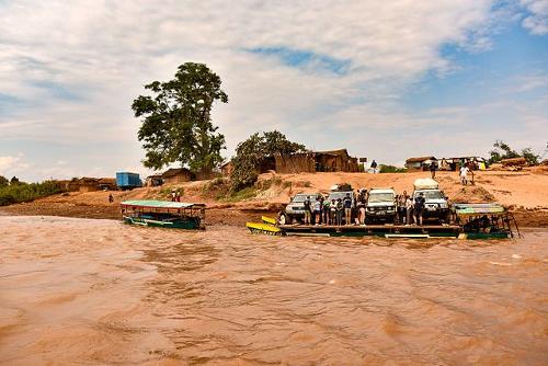
Except in the far north and south, along the west coast there is a 15 to 110 km wide, flat and swampy coastal plain. The largest rivers are Manambolo and Tsiribihina. Manambolo river, MadagascarPhoto: Rod Waddington CC 2.0 Generic no changes made
Sources
Bradt, H. / Madagascar
Bradt
Greenway, P. / Madagascar & Comoros
Lonely Planet
Lanting, F. / Madagascar : een wereld verdwaald in de tijd
Fragment
Rozeboom, A. / Madagaskar: mensen, politiek, economie, cultuur, milieu
Koninklijk Instituut voor de Tropen/Novib
Stevens, R. / Madagascar
Chelsea House Publishers
CIA - World Factbook
BBC - Country Profiles
Last updated June 2025Copyright: Team The World of Info