CURACAO

Cities in CURACAO
| Jan thiel baai | Piscadera bay | Willemstad |
Geography and Landscape
Geography
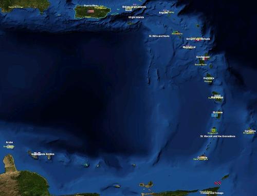
Curaçao is the largest island of the Netherlands Antilles, the middle of the Leeward Islands. It covers an area of 472 km2, with 152,000 inhabitants. It is located 60 kilometers from the South American mainland in the southern part of the Caribbean Sea. Klein-Curaçao, a small uninhabited island, is located southeast of Curaçao.
 Curacao is located bottom leftPhoto: Public domain
Curaçao originated under the sea about 100 million years ago. The oldest rock formations consist mainly of volcanic rocks. These ancient rocks were raised above sea level 60 million years ago and then surrounded by coral limestone.
Landscape
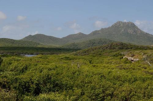
The landscape is mainly flat with some hills here and there, especially in the northwest. The highest point on Curaçao is the St. Christoffelberg (372 m). The north coast is steep and rocky, and therefore not accessible to shipping. The south coast is characterized by many bays and shallow inlets. The main inland bay is the Schottegat. There are no permanent rivers, but beds that only fill up when it has rained very hard. There are many small coral sand beaches on the southwest coast. Curaçao does not have miles of white sandy beaches.
 St. Christoffelberg, CuraçaoPhoto: Jerrye and Roy Klotz MD CC 3.0 Unported no changes
Sources
Bakker, J. / Nederlandse Antillen en Aruba
Koninklijk Instituut voor de Tropen
Encarta Encyclopedie
Erven Dorens, P. van / Curaçao
Bos & Co
Helm, R. van der / De Curaçao reisgids
Elmar
CIA - World Factbook
BBC - Country Profiles
Copyright: Team The World of Info