BELARUS

Cities in BELARUS
| Minsk |
Geography and Landscape
Geography
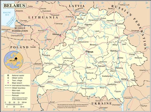
Belarus or Belarus (official name: Respublika Belarus) is located in Eastern Europe and is completely enclosed by other countries: in the north and east by Russia (959 km), Latvia (141 km2) and Lithuania (502 km) in the northwest, Ukraine to the south (891 km) and Poland (407 km) to the west. The area of Belarus is 207,600 km2.
 Belarus Topographic MapPhoto: Public Domain
Landscape
The landscape of Belarus is generally flat with many wetlands. The average height is 162 meters.
Only 8% of the landscape is hilly and the highest point is the Jarzhinskaya at 346 meters. From the Polish border in the southwest to the Russian border in the northeast, the Belaruskya Grada ("Belarusian Ridge"), named after the head of the Russian security service under Stalin, Feliks Dzjarzhinskaya, runs. River valleys cut through this ridge in a number of high plains.
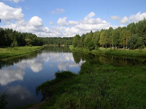
The landscape also has many primeval forests, fields, swamps, lakes and large rivers such as the Dnieper (700 km through Belarus), Dvina and Pripyat. Smaller rivers are the Berezina and the Bug. In total Belarus has about 20,800 rivers and streams with a total length of about 90,100 km.
 Landscape BelarusPhoto: Alex Zelenko CC4.0 International changes made
The lowland has many lakes and ponds, approx. 10,800, of which Lake Narach (79.6 km2) and Osveyskoye Lake (52 km2) are the largest.
The Pripet swamp area in southern Belarus was once the largest swamp area in Europe. Vast areas, however, have been drained and made suitable for agriculture.
Sources
Belarus
Lerner Publications Company
Belarus and Moldova : country studies
Federal Research Division, Library of Congress
Holtbrügge, D. / Weissrussland
Verlag C.H. Beck
Levy, P. / Belarus
Marshall Cavendish
Oost-Europa
The Reader’s Digest
Russia & Belarus
Lonely Planet
CIA - World Factbook
BBC - Country Profiles
Last updated January 2026Copyright: Team The World of Info