NEPAL
Geography and Landscape

Geography and Landscape
| Basic information | |
| Official language | Nepali |
| Capital | Kathmandu |
| Area | 147.181 km² |
| Population | 30,081,958 (2021) |
| Currency | Nepalese rupee (NPR) |
| Web | ,np |
| Code. | NPL |
| Tel. | +977 |
Cities in NEPAL
| Kathmandu |
Geography and Landscape
Geography
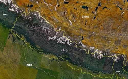
The landscape of Nepal is defined by mountain regions, the Siwalik Mountains, the central part of the Himalayas and the Mahabharat Lekh, and a swampy plain, the Terai.

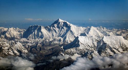
Its area is 147,000 square kilometers. The maximum length is approximately 800 kilometers and the width between 90 and 230 kilometers. The difference in height is huge from 100 meters above sea level in the Terai to the highest mountain on earth, Mount Everest in the Himalayas (8848 m.) In total there are ten peaks above 8000 meters. The main rivers are the Kali, Gandaki, Kosi and Karnali.
 Nepal: Mount Everest, highest mountain on EarthPhoto: Sshrimpo1967 CC 2.0 Generic no changes made
Sources
Encarta Ecyclopedie
Finlay, H / Nepal
Lonely Planet
Nepal
APA
CIA - World Factbook
BBC - Country Profiles
Copyright: Team The World of Info