NORTHERN IRELAND
Geography and Landscape

Geography and Landscape
| Basic information | |
| Official language | English |
| Capital | Belfast |
| Area | 13.843 km² |
| Population | 1,893,667 (2021) |
| Currency | pound sterling (GBP) |
| Web | .uk |
| Code. | GBR |
| Tel. | +44 |
Cities in NORTHERN IRELAND
| Belfast |
Popular destinations UNITED KINGDOM
| England | Northern ireland | Scotland |
| Wales |
Geography and Landscape
Geography
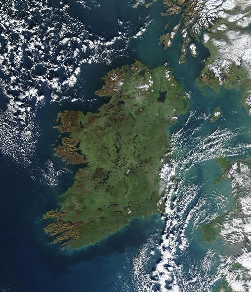
Northern Ireland, in addition to England, Scotland and Wales, is one of the four regions of the United Kingdom of Great Britain and Northern Ireland, and the only one not on the island of Great Britain. Northern Ireland is the northern part of the island of Ireland and consists of the counties of Antrim, Armagh, County Down, Fermanagh, Derry and Tyrone.
In total Northern Ireland, also called Ulster, covers an area of 14,148 km2, which is about one third of the surface of the Netherlands and one sixth of the surface of the entire Irish island.

Northern Ireland is bordered to the south and west by Ireland and further to the Atlantic Ocean and to the Irish Sea, Donegal Bay and the North Channel. Western Scotland is at the nearest point just 21 km from Northern Ireland. The coastline is approximately 362 km long and runs from Lough (Lake) Foyle in the northwest to the Morne Mountains in the southeast.
Of the many islands off the coast of Northern Ireland, some are interesting for tourists, including Tory Island, Rathlin Island and the Copeland Islands (Lighthouse Island, Great Copeland and Mew).
Landscape
In terms of landscape, Northern Ireland is very similar to the Irish Republic. It has spectacular rocky coasts and bays, green hills, high moors and many rivers. In addition, Northern Ireland has the largest lake in the UK, Lough Neagh (approx. 390 km2). Other great lakes are Lough Foyle and Lough Erne.
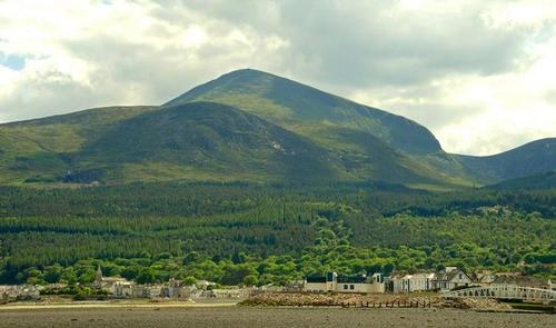
Northern Ireland has three "mountainous" regions: the Sperrin Mountains in the northwest, the Antrim Plateau along the northeast coast and the Morne Mountains in the southeast. The highest point in Northern Ireland is in the Morne Mountains: Slieve Donard with 848 meters. Other "high" peaks are Slieve Sawel with 683 meters, the Cuilcagh with 640 meters and Slieve Croob with 535 meters.
 Slieve Donard, Northern Ireland's highest mountainPhoto:Albert Bridge CC 2.0 Generic no changes made
Northern Ireland's three longest rivers are: the River Bann (129 km), the River Blackwater (160 km) and the River Lagan (60 km).
Sources
Cahill, M. J. / Northern Ireland
Chelsea House Publishers
Day, C. / North of Ireland
Cadogan
Wikipedia
CIA - World Factbook
BBC - Country Profiles
Last updated January 2026Copyright: Team The World of Info