MARSHALL ISLANDS
Geography and Landscape

Geography and Landscape
| Basic information | |
| Official language | English, Marshallese |
| Capital | Majuro |
| Area | 118 km² |
| Population | 59,872 (2021) |
| Currency | U.S. dollar (USD) |
| Web | .mh |
| Code. | MHL |
| Tel. | +692 |
Geography and Landscape
Geography
Micronesia (from the Greek: small islands) consists of approximately 2300 large and small islands. The islands are scattered in the Western Pacific between Hawaii and the Philippines. Geographically, Micronesia consists of four archipelagos: the Marshall Islands, the Mariana Islands, the Gilbert Islands and the Caroline Islands. Kiribati, which is part of Micronesia, also includes the Line Islands and Phoenix Islands, which are part of Polynesia. The distance from north to south is 2572 km and from east to west 5056 km. This means that the islands are spread over an area of more than 13 million km2.

The Marshall Islands is a sovereign republic in the Pacific Ocean, belonging to the Micronesia archipelago. It has been linked to the United States by a treaty of free association since 1986. The Marshall Islands are part of the Oceania region and lie midway between Hawaii and Papua New Guinea. The Marshall Islands consist of 1225 large and small islands and the total land area is 181.3 km2 spread over a sea area of 1,950,000 km2.
Landscape
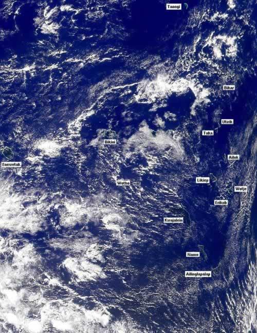
The Marshall Islands consist of two groups of atolls, namely Ralik in the west (18 atolls) and Ratak (16 atolls) in the east. The main atolls are Jaluit (land area 16.8 km2; with 95 islands), Kwajalein (28.5 km2; with 19 islands), Eniwetok (27 km2; with 38 islands) and Bikini. The largest island is Majuro (30 km2) of the atoll of the same name. The second island is Wotje (1.6 km2).
The two groups of atolls are about 240 km apart and have a length of about 1280 km. Most of the islands are small, low and include a large central lagoon. The highest point is on the island of Likiep, 10.2 metres high. The southern islands are more densely vegetated than the northern ones. Almost all the islands have beautiful white sandy beaches.
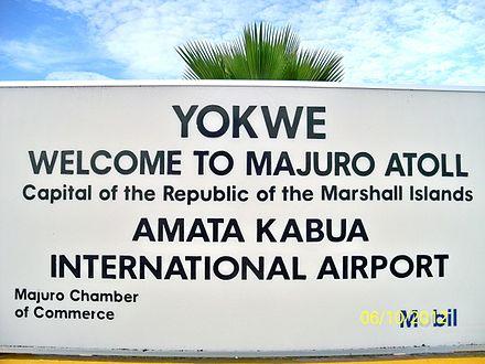
Majuro atoll
- Atoll with the most inhabitants, approx. 30,000 in an area of 30 km2.
- Majuro means "many eyes".
- Majuro consists of 57 islands in a 102 km long ellipse.
- The highest point is six metres.
- The largest islands are connected by a 56 km long road.
 Majuro atollPhoto: Public domain
Kwajalein atoll
- Largest coral atoll in the world, 2860 km2.
- Kwajalein consists of 97 islands with a total land area of 17 km2. It can only be visited with permission of the military authorities because it is a military area of the United States.
- Rockets are regularly fired at the atoll, including from California. Fierce fighting took place here during the Second World War.
- About 2,700 civilian military personnel and their families live on Kwajalein Island.
Mili atoll
- The number of inhabitants is about 850.
- The land area is 15.6 km2.
- At low tide, it is possible to walk from Mili Island to some of the other islands. The largest island is Mili Island.
Maloelap atoll
- Taroa Island was the main airbase during World War II in the eastern Marshall Islands.
- The number of residents is about 800.
- The atoll also has four uninhabited islands.
Arno atoll
- The number of islands is 133.
- The number of residents is about 1700.
- About 10,000 pounds of fish are caught annually and then sold at Majuro.
Likiep atoll
- The atoll consists of about 60 islands.
- The number of residents is about 500.
- The western style of house construction differs from the rest of the Marshall Islands.
Wotje atoll
- Het aantal bewoners van het atol bedraagt ca. 650.
- Vanuit Wotje is het mogelijk om bij eb naar andere eilanden te lopen.
- Het eiland Wotje is bezaaid met oorlogstuig uit de Tweede Wereldoorlog.
Mejit Island
- It is a coral island of 2 km2.
- The number of residents is about 450.
- The island is abundantly covered with palm trees, breadfruit trees and pandanus trees, among others.
- Mejit has a freshwater lake, very remarkable for the Marshall Islands.
Jaluit atoll
- The number of residents is about 1700.
- The atoll consists of about 95 islands.
- There is a secondary school.
- Jabwar is the main island with 800 inhabitants.
- Jaluit has the best dive sites.
Kili Island
- Kili-Island has about 900 inhabitants.
- The rough sea often makes it difficult to reach this island by boat.
- Kili-Island was uninhabited for a long time until 1948, when inhabitants of the Bikini Islands were brought here after nuclear tests on Bikini.
Aur atoll
- The population is about 450, spread across the islands of Tobal and Aur.
- The other islands are officially uninhabited, although they are used for copra production.
Ailinglaplap atoll
- The total land area is about 14.7 km2.
- The number of residents is about 1700.
- It is one of the largest copra producers.
- The island of Woja is about 11 km long with about 600 inhabitants.
- There is a good school and many speak English well.
Bikini atoll
- One of the first inhabited islands of Micronesia.
- Here the first atomic bomb fell in peacetime, as a test. Later, 23 more nuclear tests followed.
- The original 161 inhabitants were first taken to the Rongerik atoll and then to Kili-Island.
- The atoll is still uninhabitable; only scientists and construction workers live there.
Eniwetok atoll
- Nuclear tests were also held here, 43 in ten years.
- The inhabitants were evacuated to the Ujelang atoll.
- In 1980, the islanders were allowed to return.
- At Runit, all the radioactive waste is buried under a 40 cm thick concrete layer.
Rongelap atoll
- The inhabitants were evacuated only after the atomic bomb exploded over Bikini in 1954.
- The residents were allowed to return in 1957.
- Many still have health problems such as cancer and miscarriages.
Other atolls include Wotho, Ailuk and Namorik. Bikar, Taka, Jemo and Taongi are uninhabited.
Sources
Galbraith, K. / Micronesia
Lonely Planet
Levy, N.M. / Micronesia handbook Moon
CIA - World Factbook
BBC - Country Profiles
Copyright: Team The World of Info