SAMOA

Geography and Landscape
Geography

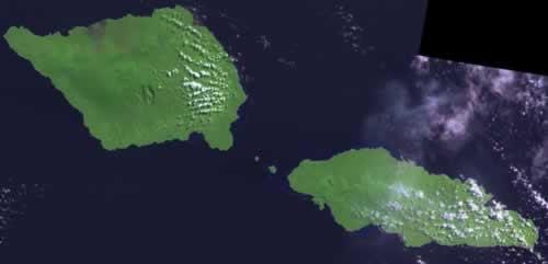
The islands of Samoa comprise independent Western Samoa and American Samoa. Western Samoa has best preserved its own identity and traditions. Certainly in comparison with the other countries in the Atlantic Ocean, which are all subject to various influences. There are volcanoes on the island and some parts are buried under hardened lava.
Samoa is located on the east side of the Datum Line and south of the equator, about halfway between Hawaii and New Zealand, in the Polynesian region of the Pacific Ocean. The total land area is 2934 km² and consists of the two islands of Upolu and Savai'i, which comprise 99% of Samoa's land area, and eight smaller islets: the three islands in the Strait of Apolima (Manono Island, Apolima and Nu'ulopa), the four Aleipata islands a little to the east of Upolu (Nu'utele, Nu'ulua, Namua and Fanuatapu), and the islet of Nu'usafe'e (smaller than 0.01 km² in area and about 1.4 km off the southern coast of Upolu)
The nearest surrounding islands are Tokelau in the north, French Polynesia in the east, Niue in the south and Fiji in the west. Further to the northwest is the island of Papua New Guinea, to the southwest Australia and further to the northeast is Mexico. Savai'i has an area of 1700 km2 and Upolu 1115 km2. The highest point in Samoa is on Savai'i and is called Mount Silisili with an altitude of 1858 m.
The area of American Samoa is 197 km2. Tutuila is a long, narrow island with many valleys. The Samoa Islands have a volcanic origin. On Tutuila, most of the volcanoes are worked out, in contrast to the volcanoes on Savai'i and Upolu. The most specific thing about the Samoa Islands is their volcanic origin.
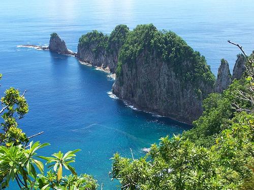
 Pola Iskands off the coast of TutuilaPhoto: Tavita Togia National Park Service in het publieke domein
Climate and Weather
The Samoa Islands lie around the equator, hence the climate is hot and humid during most days of the year. The months of November to April are the wet season. The dry season is from May to October. The average temperature is 26 °C along the coast. Inland, the temperature is a little lower, where it is also more humid and cloudy. The average annual rainfall on the Samoa Islands is 5000 mm. December and January are the wettest months in American Samoa. Cyclones and tropical storms occur between the months of November and April.
Plants and Animals
Plants
Tropical rainforest grows on the Samoa Islands, but it is threatened by increasing population and western influences. On Western Samoa, the rainforest covers only 37% of the total area. On the high plains of Savai'i, Upolu, Ofu, Olosega and Ta'u, tree ferns, grasses and other tropical plants grow. Especially on Savai'i and Upolu the banyan tree is dominant. The tropical rainforest on Savai'i consists of 75 plant species.
The national tree of Samoa is the coconut palm.
Animals
Because the Samoa Islands are somewhat remote, far out in the Pacific Ocean, there are few wild animal species living there. Animals that do occur there include the Polynesian rat, mammals and bats. Whales and dolphins can also be found among the Samoa Islands, depending on the season. A special species on Ta'u is the green turtle. There are not many birds on the islands, because the population found them good to eat. On American Samoa, there are about 59 species of birds. Along the coast there are 900 different species of tropical fish. On the islands there are two national parks. In the south of Upolu there is O Le Pupu-Pu'e National Park.
Sources
Elmar Landeninformatie
Wikipedia
CIA - World Factbook
BBC - Country Profiles
Copyright: Team The World of Info