PEMBA

Popular destinations TANZANIA
| Pemba | Zanzibar |
Geography and Landscape
Geography
Pemba is a Tanzanian island belonging to Zanzibar province, together with the main island of Unguja or Zanzibar Island.
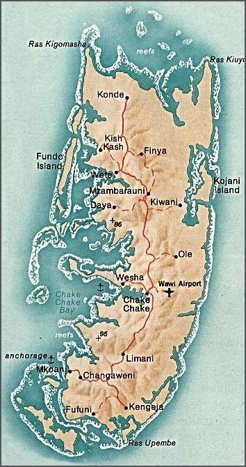
 Pemba MapPhoto: Public Domain
Pemba is located about 80 km north of Unguja and almost as far from the Tanzanian mainland. Pemba is almost 70 kilometres long, about 23 kilometres wide and covers an area of about 980 km2.
Landscape
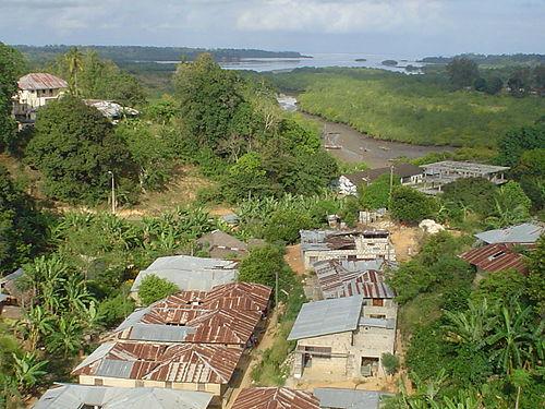
Unlike Zanzibar Island, Pemba has a rocky surface. As a result, Pemba is much more densely forested and hilly, with peaks of up to one hundred metres. The Arabs used to call the island 'El Huthera', the 'green island'.
A large part of the coast is surrounded by mangrove swamps, which in turn are surrounded by beautiful coral reefs. Pemba has few sandy beaches.
Countless small and uninhabited islands lie along the coast of Pemba. The many pools with many water plants are special.
 Landscape South PembaPhoto: Vincent van Zeijst CC BY-SA 3.0 no changes made
Sources
Else, D. / Zanzibar
Bradt
Finke, J. / Tanzania
Rough Guides
Fitzpatrick, M. / Tanzania
Lonely Planet
Heale, J. / Tanzania
Marshall Cavendish
Skinner, A. / Tanzania & Zanzibar
Cadogan
CIA - World Factbook
BBC - Country Profiles
Copyright: Team The World of Info