KUWAIT

Geography and Landscape
Geography
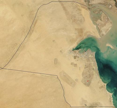
Kuwait is situated in the Middle East. To the west and north of Kuwait lies Iraq, to the east lies the Persian Gulf and to the south Saudi Arabia.

A number of islands off the coast also belong to Kuwait. The largest of these are Bubiyãn, Warhab and Faylakah. The area of Kuwait is 17,820 square kilometres.
Landscape
Kuwait consists mainly of gravel desert and sandy plains, with only a few hills (up to 300 m high), some crescent dunes (barchans) and some oases. The desert gets higher from the northeast to the southwest. Along the coast are shallows and swamps. The islands in the north were created by silt deposits. Kuwait has no rivers or lakes.
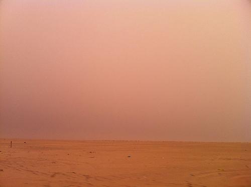
 Sandstorm in the desert of KuwaitPhoto: Kuwaitsoccer CC BY-SA 3.0 no changes made
Climate and Weather
Kuwait has a distinctive desert climate with very hot summers and short, somewhat cooler winters. The country is one of the hottest countries in the world. During the summer months, the average temperature is around 25 °C, with peaks of 60 °C. In the winter, it can sometimes freeze and there is some precipitation. In the winter, it can sometimes freeze and there is some precipitation. The average precipitation is between 10 and 200 mm per year.
Plants and Animals
Plants
Kuwait has little flora. After a period of rain, cacti and some bushes grow in the desert. In a few oases, date palms grow. The salt marshes are characterised by the salt water plants that grow there. Common crops are cactus, date palm, grain, grass, melon and tomato.
Animals
The animal world is also limited due to the severe drought. Common animals are shrimp, goat, camel, crab, hare, chicken, sheep and falcon.
Sources
Elmar Landeninformatie
CIA - World Factbook
BBC - Country Profiles
Copyright: Team The World of Info