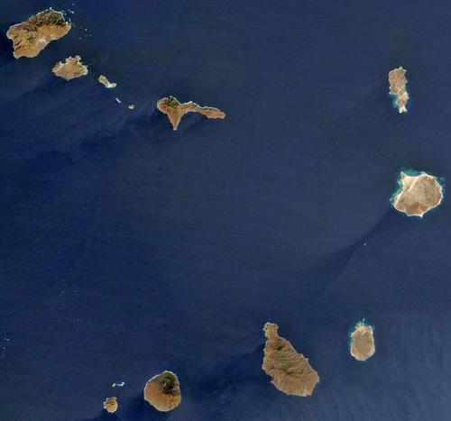
CAPE VERDE


Geography and Landscape
Geography
Cape Verde is divided into a northern archipelago comprising the islands of Boa Vista, Branco, Razo Sal, Santa Luzia, Santo Antao, Sao Nicolau and Sao Vincente and a southern archipelago comprising Brava, Fogo, Maio and Santiago. Cape Verde owes its name to its location on the Green Cape, which is the westernmost point of Afica in Senegal.
Landscape
The landscape of Cape Verde is generally mountainous. The still active volcano Pico do Fogo (2829 metres high) is the highest point of the archipelago.

Deep ravines, created by erosion, cut through the strongly hilly landscape. Irregular rainfall has caused problems with erosion and a shortage of fresh drinking water. In the late 1980s, however, the construction of terraces and dams and the planting of around 20 million trees attempted to halt erosion.
Sources
Grote Lekturama wereldatlas
Lekturama
Irwin, A. / Cape Verde Islands
The Globe Pequot Press
Osang, R. / Kapverdische Inseln
DuMont
Schleich, H.H. / Cabo Verde
Naglschmid
CIA - World Factbook
BBC - Country Profiles
Copyright: Team The World of Info