VIETNAM

Cities in VIETNAM
| Hanoi |
Geography and Landscape
Geography
Vietnam (Vietnamese, = Country of the South) (officially: Viêt Nam Công Hòa Xa Hôi Chu 'Nghiã = Socialist Republic of Vietnam) is a republic in Southeast Asia. The total area of the country is over 330,000 km2.
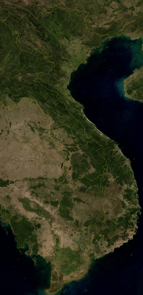
 Vietnam Satellite photoPhoto: Public Domain
Vietnam is bordered to the north by China (1281 km), to the northwest by Laos (2130 km) and in the southwest at Cambodia (950 km). The maximum distance from north to south is 1,650 kilometers and the width of the country varies from a maximum of 600 kilometers to 50 kilometers in the center of the country between Laos and the South China Sea. The total coastline is more than 2500 kilometers long and runs from north to south along the Gulf of Tonkin, the South China Sea or Bien Dong and the Gulf of Thailand. These are largely natural borders, as Vietnam is separated from Laos and Cambodia by the Truong Son Mountains.
The territory of Vietnam includes a chain of thousands of islands and the government also claims a number of other islands, including the Paracel Islands (400 kilometers east of Da Nang) and the Spratley Islands (500 kilometers from the southeast coast).
Vietnam's largest island, Phu Quoc, is located in the Gulf of Thailand, just outside the territorial waters of Cambodia , 45 kilometers from Ha Tien. Phu Quoc is kilometers long and 30 kilometers wide and has an area of approximately 1,300 km2. Phu Quoc belongs to the 16-island archipelago Dao Phu Quoc.
Landscape
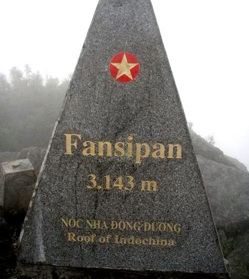
The largest part of Vietnam, approx. 75%, consists of mountains and hills. In the mountainous north of Bac Bo is also the large, densely populated delta (approx. 15,000 km2) of the Song Hong, the Red River. The river owes its name to the red sediments it carries with it. This river is more than 1200 kilometers long and has its source in China's Yunnan province and flows to the Gulf of Tonkin in the southeast. To prevent flooding in the rainy season there are huge dikes along the river. The vast mountain country in the north, the Hoang Lien Mountains, is a continuation of the mountain country of Southeast China with the highest peak being the Phan Si Pan at 3,143 meters. This mountain range also forms the border with China in the north and Laos in the northwest. This area used to be almost completely forested, but now completely bare due to centuries of logging and burning for agriculture.
 Phan Si Pan, highest point of Vietnam and Indo-ChinaPhoto: Phonglanpls CC 3.0 Unported no changes made
Central Vietnam or Trung Bo has a narrow coastline that merges into the Cordillera of Annam or Truong Son, which forms the border with Laos and Cambodia for more than 1200 kilometers. Here are a number of mountains that are between 1000 and 2000 meters high. The coastal strip here consists of beaches, lagoons and dunes.
South Vietnam or Nam Bo is hilly with the Mekong Delta at its core with an area of 40,000 km2. The gigantic Mekong (Cuu Long Giang = River of the Nine Dragons) eventually flows through a number of countries through Vietnam for 222 kilometers and then flows into the South China Sea. The fertile silt that is constantly deposited here makes the Mekong Delta an area characterized by endless rice fields. Due to the continuous silting, the territory of Vietnam is expanded by a few dozen meters every year.
Sources
Krücker, F.-J. / Vietnam
Elmar
Paulzen, H. / Vietnam : mensen, politiek, economie, cultuur, milieu
Koninklijk Instituut voor de Tropen
Peterse, L. / Vietnam
Gottmer/Becht
Te gast in Vietnam
Informatie Verre Reizen
Vietnam
Cambium
Vietnam
Lannoo
Wulf, A. / Vietnam
Het Spectrum
CIA - World Factbook
BBC - Country Profiles
Last updated January 2026Copyright: Team The World of Info