SRI LANKA
Geography and Landscape

Geography and Landscape
| Basic information | |
| Official language | Sinhala, Tamil |
| Capital | Sri Jayewardenepura Kotte |
| Area | 65.610 km² |
| Population | 21,570,428 (2021) |
| Currency | Sri Lankan rupee (LKR) |
| Web | .lk |
| Code. | LKA |
| Tel. | +94 |

Cities in SRI LANKA
| Colombo |
Geography and Landscape
Geography
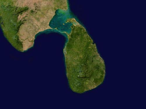
The Republic of Sri Lanka (officially: Democratic Socialist Republic of Sri Lanka; before 1972: Ceylon) is an island in the Indian Ocean and is located southeast of the southern tip of India. Sri Lanka is called the 'Pearl of the Indian Ocean'.
Sri Lanka is separated from India by the 48 kilometre wide Palk Strait. A kind of direct connection with India is formed by the so-called Adam's Bridge, a collection of sand banks, coral reefs and islets, which extends from the islet of Mannar to the Indian mainland.
The total area of the country is 65,610 square kilometres. From north to south Sri Lanka measures 445 kilometres and from east to west 225 kilometres at most. The total coastline of Sri Lanka is about 1340 kilometres and the island is located 650 kilometres north of the equator.
Apart from the main island, Sri Lanka also has about twenty smaller islands, most of which are located just off the coast of the northern peninsula of Jaffna, Kayts, Punkudutiva and Delft, among others.

Landscape
Geologically, Sri Lanka is part of India's Decca plateau, which was even linked to the East Indies in certain ice ages. A very long time ago, the Decca plateau was a mighty mountain range, which in a subsequent period of 60 million years eroded and weathered and was eroded by the many monsoon rains. Slowly but surely Sri Lanka acquired its present form, a landscape with rounded shapes and little difference in height.
More than three-quarters of Sri Lanka looks like this today, but varies from a fertile lowland in the southwest to dry plains in the north, east and south, even desert-like areas. In 1881, 84% of Sri Lanka was covered with forests, in 2002 this had decreased to 19%.
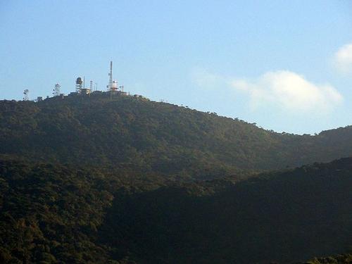
The central part of the island is mountainous and is cut by deep valleys. Here are a number of mountain peaks, including the Pidurutalagala or Mount Pedro with 2524 meters the highest mountain in Sri Lanka. Other high peaks are the Kirigalpotta (2394 m), the Totapalakanda (2356 m) and the holy Sri Pada (Samanalakanda) or Adam's Peak (2243 m).
 Pidurutalagala or Mount Pedro, Sri Lanka's highest mountainPhoto: Rehman Abubakr CC 4.0 International no changes made
The coastal strip is generally regular and flat, but in some places there are islands, lagoons, coral reefs and bays off the coast. The coastal plains are narrower in the south (50-60 km) than in the north.
The far north of Sri Lanka is formed by the Jaffna peninsula, which is surrounded by a number of islands. The peninsula is connected to the rest of the island by a narrow sandbank, Elephant Pass.
In the south-east and north-west are savannahs and small desert areas. This part of the country is characterised by thousands of artificial lakes or 'tanks' (Sinhalese, wewa; Tamil, kulam) that have irrigated the dry land, often since ancient times. A vast dune landscape near Point Pedro is sometimes referred to as the 'Little Sahara'.
The almost treeless savannahs gradually flow into monsoon forests.
The approximately 100 rivers, which all originate in the central mountainous area and flow to the coast via many rapids, are often wide and short. The longest river is the 321 km long Mahaweli Ganga, which forms a delta full of swamps and mangrove forests south of Trincomalee. After that, the wide river shrinks to a small stream. Much shorter is the Kelani, which flows into the sea just north of the capital Colombo. This river is the only one navigable for tens of kilometres inland. The shortest river is the Gal Oya with only 108 km. Ganga' is called a large river, 'oya' a small river.
The most famous waterfalls are the Dunhinda (61 m) and the Diyaluma. The highest waterfall in Sri Lanka is the Bambarakanda (264 m).
Sources
Bradnock, R.W. / Sri Lanka handbook : the travel guide
Footprint Handbooks
Geetha Kumari, W.M. / Reishandboek Sri Lanka
Elmar,
Laet, R. de / Sri Lanka en de Malediven
Kosmos-Z&K
Plunkett, R. / Sri Lanka
Lonely Planet
Rokebrand, R. / Sri Lanka
Gottmer/Becht
Schiller, B. / Sri Lanka
Van Reemst
Sprang, U. / Sri Lanka : mensen, politiek, economie, cultuur, milieu
Koninklijk Instituut voor de Tropen
Sri Lanka
Cambium
Te gast in Sri Lanka
Informatie Verre Reizen
Wanasundera, N.P. / Sri Lanka
Benchmark Books
CIA - World Factbook
BBC - Country Profiles
Copyright: Team The World of Info